
Bestand:Montgomerytownships.PNG
Grootte van deze voorvertoning: 563 × 600 pixels. Andere resoluties: 225 × 240 pixels | 451 × 480 pixels | 724 × 771 pixels.
Oorspronkelijk bestand (724 × 771 pixels, bestandsgrootte: 57 kB, MIME-type: image/png)
| Dit is een bestand van Wikimedia Commons. Onderstaande beschrijving komt van de beschrijving van het bestand daar. |
Beschrijving
| Beschrijving |
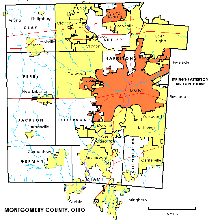
English: The image depicts the administrative divisions of Montgomery County, Ohio; cities, villages, CDPs, and townships |
| Bron | Self-created from US Federal Census maps and data. |
| Auteur | United States Census Bureau |
Licentie
This image or file is a work of a United States Census Bureau employee, taken or made as part of that person's official duties. As a work of the U.S. federal government, the image is in the public domain.
|
 |
Oorspronkelijk uploadlogboek
De oorspronkelijke beschrijving van deze afbeelding stond hier. Alle volgende gebruikersnamen verwijzen naar en.wikipedia.
- 2006-06-20 21:50 Prinzwilhelm 724×771× (58876 bytes) Self-created from US Federal Census maps and data.)
- 2006-06-20 21:48 Prinzwilhelm 724×771× (58599 bytes) Self-created from US Federal Census maps and data.) (version lost by MediaWiki)
- 2006-06-20 20:47 Prinzwilhelm 724×771× (58613 bytes) Self-created from US Federal Census maps and data.) (version lost by MediaWiki)
- 2006-06-20 17:24 Prinzwilhelm 724×771× (58465 bytes) Self-created from US Federal Census maps and data. (version lost by MediaWiki)
- 2006-06-20 16:51 Prinzwilhelm 724×771× (58371 bytes) Self-created from US Federal Census maps and data. (version lost by MediaWiki)
Bestandsgeschiedenis
Klik op een datum/tijd om het bestand te zien zoals het destijds was.
| Datum/tijd | Miniatuur | Afmetingen | Gebruiker | Opmerking | |
|---|---|---|---|---|---|
| huidige versie | 15 jan 2012 01:57 | | 724 × 771 (57 kB) | Wars |
Bestandsgebruik
Dit bestand wordt op de volgende pagina gebruikt:
Globaal bestandsgebruik
De volgende andere wiki's gebruiken dit bestand:
- Gebruikt op de.wikipedia.org
- Gebruikt op en.wikipedia.org
- Gebruikt op ja.wikipedia.org
- Gebruikt op ro.wikipedia.org