
Bestand:Naddniestrze-administracja.png

Grootte van deze voorvertoning: 408 × 599 pixels. Andere resoluties: 163 × 240 pixels | 327 × 480 pixels | 922 × 1.354 pixels.
Oorspronkelijk bestand (922 × 1.354 pixels, bestandsgrootte: 155 kB, MIME-type: image/png)
| Dit is een bestand van Wikimedia Commons. Onderstaande beschrijving komt van de beschrijving van het bestand daar. |
Beschrijving
| Beschrijving |
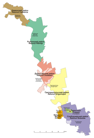
English: Administrative divisions of Pridnestrovie
Polski: Mapa administracyjna Naddniestrza |
| Datum | |
| Bron | Eigen werk |
| Auteur | Aotearoa |
Licentie
Ik, de auteursrechthebbende van dit werk, maak het hierbij onder de volgende licenties beschikbaar:

|
Toestemming wordt verleend voor het kopiëren, verspreiden en/of wijzigen van dit document onder de voorwaarden van de GNU-licentie voor vrije documentatie, versie 1.2 of enige latere versie als gepubliceerd door de Free Software Foundation; zonder Invariant Sections, zonder Front-Cover Texts, en zonder Back-Cover Texts. Een kopie van de licentie is opgenomen in de sectie GNU-licentie voor vrije documentatie. |
| Dit bestand is gelicenseerd onder de Creative Commons-licentie Naamsvermelding-Gelijk delen 3.0 Unported | ||
| ||
| Deze licentietag is toegevoegd aan dit bestand in verband met de GFDL licentie-update. |
U mag zelf één van de licenties kiezen.
Bestandsgeschiedenis
Klik op een datum/tijd om het bestand te zien zoals het destijds was.
| Datum/tijd | Miniatuur | Afmetingen | Gebruiker | Opmerking | |
|---|---|---|---|---|---|
| huidige versie | 28 mrt 2019 10:27 | | 922 × 1.354 (155 kB) | Aotearoa | Reverted to version as of 14:08, 3 August 2015 (UTC) - incorrect text |
| 13 aug 2017 21:33 |  | 922 × 1.354 (59 kB) | MAXHO | Correction according with all sources and travellers, with NordNordWest's map [https://commons.wikimedia.org/wiki/File:Moldova_location_map.svg], with Aotearoa's original maps [https://commons.wikimedia.org/wiki/File:Naddniestrze.png], [https://common... | |
| 23 feb 2017 19:14 |  | 922 × 1.354 (43 kB) | Nicolay Sidorov | de-facto borders | |
| 3 aug 2015 16:08 |  | 922 × 1.354 (155 kB) | Aotearoa | Reverted to version as of 20:17, 26 August 2008 - this is map in Polish, English text might be added in duplicated file | |
| 2 aug 2015 19:02 |  | 922 × 1.354 (171 kB) | Spiridon Ion Cepleanu | Legend of the striped areas | |
| 26 aug 2008 22:17 |  | 922 × 1.354 (155 kB) | Aotearoa | {{Information |Description={{en|1=Administrative divisions of Transnistria}} {{pl|1=Mapa administracyjna Naddniestrza}} |Source=Praca własna osoby przesyłającej (own work by uploader) |Author=Aotearoa |Date=26.08.2008 |Permission= |ot |
Bestandsgebruik
Geen enkele pagina gebruikt dit bestand.
Globaal bestandsgebruik
De volgende andere wiki's gebruiken dit bestand:
- Gebruikt op ca.wikipedia.org
- Gebruikt op csb.wikipedia.org
- Gebruikt op de.wikipedia.org
- Gebruikt op gag.wikipedia.org
- Gebruikt op pl.wikipedia.org
- Gebruikt op pl.wikivoyage.org
- Gebruikt op ru.wikipedia.org
- Gebruikt op tr.wikipedia.org
- Gebruikt op uk.wikipedia.org