
Bestand:Newcastle-under-Lyme UK locator map.svg

Afmetingen van deze voorvertoning van het type PNG van dit SVG-bestand: 470 × 599 pixels Andere resoluties: 188 × 240 pixels | 377 × 480 pixels | 603 × 768 pixels | 803 × 1.024 pixels | 1.607 × 2.048 pixels | 1.024 × 1.305 pixels.
Oorspronkelijk bestand (SVG-bestand, nominaal 1.024 × 1.305 pixels, bestandsgrootte: 1,03 MB)
| Dit is een bestand van Wikimedia Commons. Onderstaande beschrijving komt van de beschrijving van het bestand daar. |
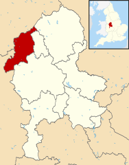
| Beschrijving | Map of Staffordshire, with Newcastle-under-Lyme highlighted. |
| Datum | (UTC) |
| Bron | |
| Auteur |
|
.svg)
Ik, de auteursrechthebbende van dit werk, maak het hierbij onder de volgende licentie beschikbaar:
Dit bestand is gelicenseerd onder de Creative Commons-licentie Naamsvermelding-Gelijk delen 3.0 Unported
- De gebruiker mag:
- Delen – het werk kopiëren, verspreiden en doorgeven
- Remixen – afgeleide werken maken
- Onder de volgende voorwaarden:
- naamsvermelding – U moet op een gepaste manier aan naamsvermelding doen, een link naar de licentie geven, en aangeven of er wijzigingen in het werk zijn aangebracht. U mag dit op elke redelijke manier doen, maar niet zodanig dat de indruk wordt gewekt dat de licentiegever instemt met uw werk of uw gebruik van zijn werk.
- Gelijk delen – Als u het werk heeft geremixt, veranderd, of erop heeft voortgebouwd, moet u het gewijzigde materiaal verspreiden onder dezelfde licentie als het oorspronkelijke werk, of een daarmee compatibele licentie.
Oorspronkelijk uploadlogboek
This image is a derivative work of the following images:
- File:Staffordshire UK district map (blank).svg licensed with Cc-by-sa-3.0
- 2010-08-22T08:19:06Z Nilfanion 1024x1305 (1081109 Bytes) +inset, water colour tweak
- 2010-07-16T23:54:44Z Nilfanion 1024x1305 (711394 Bytes) {{Information |Description=Map of [[w:Staffordshire|Staffordshire]], UK with districts shown. Equirectangular map projection on WGS 84 datum, with N/S stretched 165% Geographic limits: *West: 2.50W *East: 1.40W *North: 53.2
Bestandsgeschiedenis
Klik op een datum/tijd om het bestand te zien zoals het destijds was.
| Datum/tijd | Miniatuur | Afmetingen | Gebruiker | Opmerking | |
|---|---|---|---|---|---|
| huidige versie | 12 aug 2011 22:30 | | 1.024 × 1.305 (1,03 MB) | Renly~commonswiki | {{Information |Description=Map of Staffordshire, with Newcastle-under-Lyme highlighted. |Source=*Staffordshire UK district map (blank).svg |Date=2011-08-12 20:30 (UTC) |Author=*[[:File:Staffordshire UK d |
.svg)
Bestandsgebruik
Dit bestand wordt op de volgende pagina gebruikt:
Globaal bestandsgebruik
De volgende andere wiki's gebruiken dit bestand:
- Gebruikt op cy.wikipedia.org
- Gebruikt op en.wikipedia.org
- Gebruikt op es.wikipedia.org
- Gebruikt op it.wikipedia.org
- Gebruikt op ja.wikipedia.org
- Gebruikt op ko.wikipedia.org
- Gebruikt op pl.wikipedia.org
- Gebruikt op ru.wikipedia.org
- Gebruikt op sv.wikipedia.org
- Gebruikt op ur.wikipedia.org
- Gebruikt op www.wikidata.org
- Gebruikt op zh-min-nan.wikipedia.org