
Bestand:Nora (LANDSAT).png

Grootte van deze voorvertoning: 551 × 599 pixels. Andere resoluties: 221 × 240 pixels | 441 × 480 pixels | 878 × 955 pixels.
Oorspronkelijk bestand (878 × 955 pixels, bestandsgrootte: 1,04 MB, MIME-type: image/png)
| Dit is een bestand van Wikimedia Commons. Onderstaande beschrijving komt van de beschrijving van het bestand daar. |
Beschrijving
| Beschrijving |
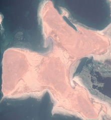
Deutsch: Landsat-Bild von Nora (Norah)
English: Satellite image of Nora (not Nahaleg!) |
|||
| Datum | ||||
| Bron |
NASA World Wind, OnEarth WMS Global Mosaic visual color layer. Coordinates: |
|||
| Auteur | NASA World Wind | |||
| Toestemming (Hergebruik van dit bestand) |
|

.png)
Bestandsgeschiedenis
Klik op een datum/tijd om het bestand te zien zoals het destijds was.
| Datum/tijd | Miniatuur | Afmetingen | Gebruiker | Opmerking | |
|---|---|---|---|---|---|
| huidige versie | 19 nov 2006 21:26 | | 878 × 955 (1,04 MB) | Hautala | cropped |
| 19 nov 2006 20:47 |  | 1.280 × 974 (1,56 MB) | Hautala | {{PD-WorldWind}} Satellite image of Nagaleg. Image captured from NASA World Wind, OnEarth WMS visual color layer. Coordinates: worldwind://goto/world=Earth&lat=16.04546&lon=40.06094&alt=19851 Category:Red Sea [[Category:Satellite images of islands |
Bestandsgebruik
Dit bestand wordt op de volgende pagina gebruikt:
Globaal bestandsgebruik
De volgende andere wiki's gebruiken dit bestand:
- Gebruikt op ar.wikipedia.org
- Gebruikt op arz.wikipedia.org
- Gebruikt op az.wikipedia.org
- Gebruikt op ceb.wikipedia.org
- Gebruikt op de.wikipedia.org
- Gebruikt op en.wikipedia.org
- Gebruikt op es.wikipedia.org
- Gebruikt op fi.wikipedia.org
- Gebruikt op ka.wikipedia.org
- Gebruikt op pl.wikipedia.org
- Gebruikt op pt.wikipedia.org
- Gebruikt op ru.wikipedia.org
- Gebruikt op uk.wikipedia.org
- Gebruikt op www.wikidata.org
.png)