
Bestand:North Yorkshire UK relief location map.jpg

Grootte van deze voorvertoning: 800 × 582 pixels. Andere resoluties: 320 × 233 pixels | 640 × 466 pixels | 1.024 × 745 pixels | 1.280 × 932 pixels | 1.999 × 1.455 pixels.
Oorspronkelijk bestand (1.999 × 1.455 pixels, bestandsgrootte: 466 kB, MIME-type: image/jpeg)
| Dit is een bestand van Wikimedia Commons. Onderstaande beschrijving komt van de beschrijving van het bestand daar. |
| Beschrijving |
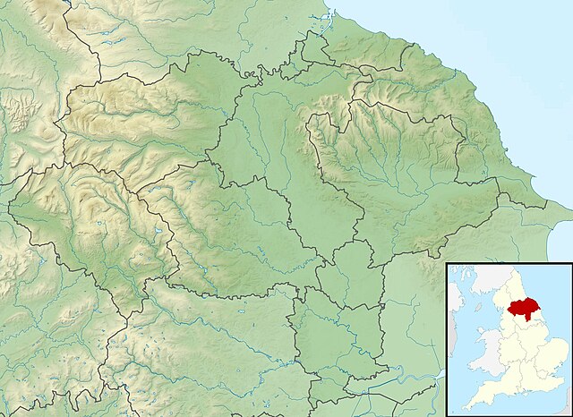
Relief map of North Yorkshire, UK. Equirectangular map projection on WGS 84 datum, with N/S stretched 170% Geographic limits:
|
| Datum | |
| Bron |
|
| Auteur | Nilfanion, created using Ordnance Survey data |
| Toestemming (Hergebruik van dit bestand) |
Dit bestand is gelicenseerd onder de Creative Commons-licentie Naamsvermelding-Gelijk delen 3.0 Unported Naamsvermelding: Contains Ordnance Survey data © Crown copyright and database right
|
| Andere versies | File:North Yorkshire UK district map (blank).svg - Blank map |
.svg)
Bestandsgeschiedenis
Klik op een datum/tijd om het bestand te zien zoals het destijds was.
| Datum/tijd | Miniatuur | Afmetingen | Gebruiker | Opmerking | |
|---|---|---|---|---|---|
| huidige versie | 29 nov 2011 03:47 | | 1.999 × 1.455 (466 kB) | Nilfanion | {{Information |Description=Relief map of North Yorkshire, UK. Equirectangular map projection on WGS 84 datum, with N/S stretched 170% Geographic limits: *West: 2.60W *East: 0.10W *North: 54.67N *South: 53.60N |Source=[[w:Ordnance S |
Bestandsgebruik
Dit bestand wordt op de volgende pagina gebruikt:
Globaal bestandsgebruik
De volgende andere wiki's gebruiken dit bestand:
- Gebruikt op ar.wikipedia.org
- Gebruikt op bg.wikipedia.org
- Gebruikt op ceb.wikipedia.org
- Gebruikt op da.wikipedia.org
- Gebruikt op en.wikipedia.org
- Battle of Marston Moor
- Roseberry Topping
- River Esk, North Yorkshire
- Studley Royal Park
- Cock Beck
- Tan Hill, North Yorkshire
- Malham Tarn
- Siege of York
- Roundhill Reservoir
- Angram Reservoir
- Scar House Reservoir
- Cod Beck Reservoir
- Boulby Quarries
- Langbaurgh Ridge
- Lovell Hill Pools
- Saltburn Gill
- Pinkney and Gerrick Woods
- Redcar Rocks
- South Gare & Coatham Sands SSSI
- Semerwater
- Fewston Reservoir
- Swinsty Reservoir
- Thruscross Reservoir
- Winterburn Reservoir
- Lindley Wood Reservoir
- Newby Hall
- British PGA Matchplay Championship
- Gouthwaite Reservoir
- Leighton Reservoir
- Thornton Steward Reservoir
- Scarborough Mere
- Gragareth
- River Seven
- Ganton Golf Club
- Grimwith Reservoir
- Embsay Reservoir
- Great Stone of Fourstones
- Chelker Reservoir
- Murphy's Cup
- Guildford Slingsby
- Bishopdale Beck
Globaal gebruik van dit bestand bekijken.