
Bestand:Obcine Slovenija 2006 Sentrupert.svg

Afmetingen van deze voorvertoning van het type PNG van dit SVG-bestand: 800 × 522 pixels Andere resoluties: 320 × 209 pixels | 640 × 418 pixels | 1.024 × 668 pixels | 1.280 × 835 pixels | 2.560 × 1.670 pixels | 2.613 × 1.705 pixels.
Oorspronkelijk bestand (SVG-bestand, nominaal 2.613 × 1.705 pixels, bestandsgrootte: 2,36 MB)
| Dit is een bestand van Wikimedia Commons. Onderstaande beschrijving komt van de beschrijving van het bestand daar. |
Beschrijving
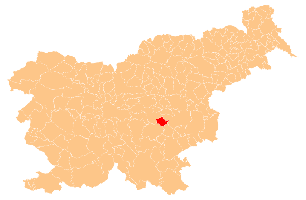
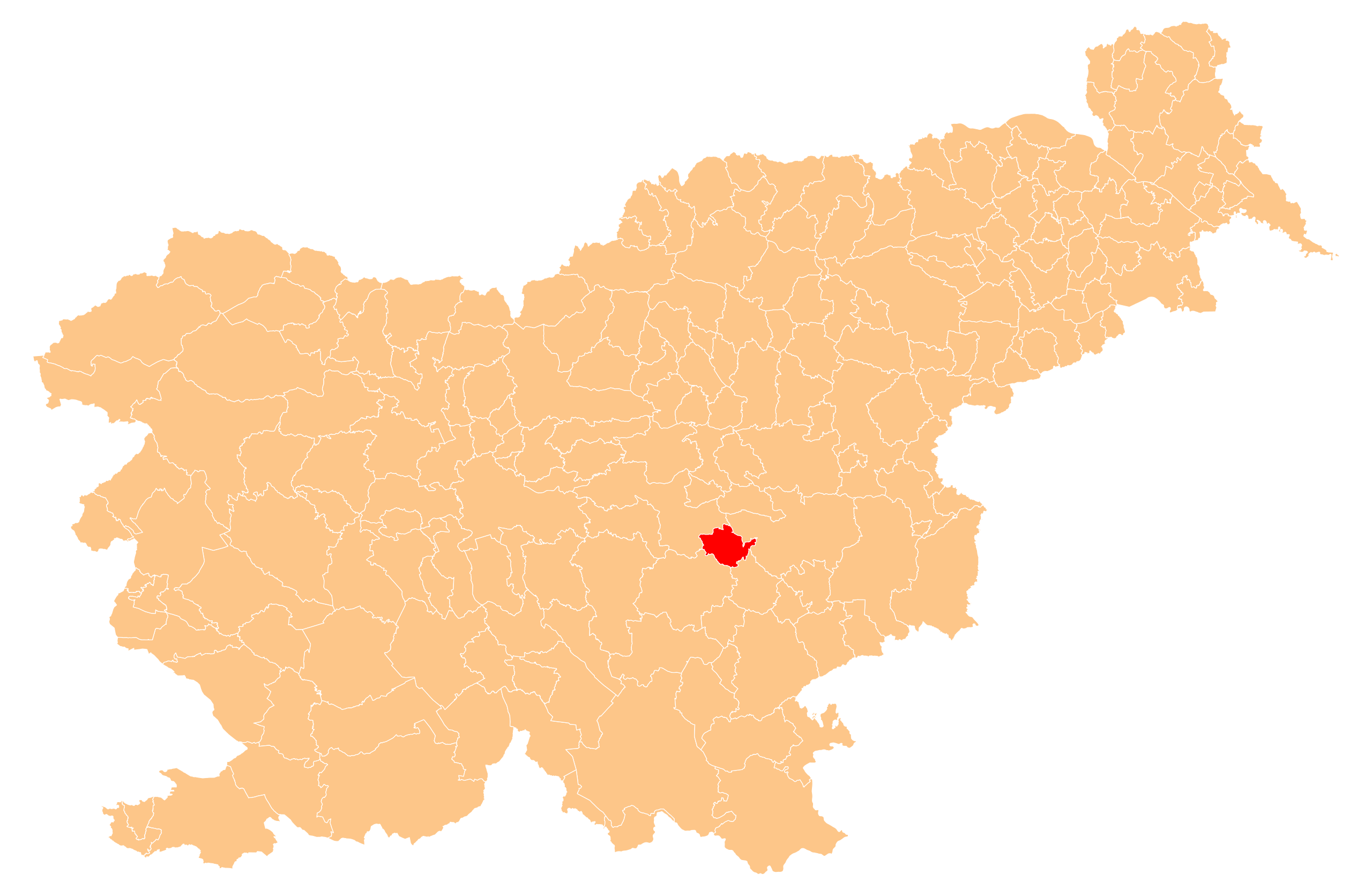
| Beschrijving | Občina Šentrupert (marked red) on map of the municipalities (občine) of the Republic of Slovenia, as since May 2006 (210 units). |
| Datum | |
| Bron | Manipulated Image:Obcine Slovenija 2006.svg in text editor. |
| Auteur | Source of the public data is GURS (Geodetska uprava Republike Slovenije or Surveying and Mapping Authority of the Republic of Slovenia). Converted from Shapefile to SVG with shp2svg and prepared for Wikipedia by romanm (talk). |
| Toestemming (Hergebruik van dit bestand) |
Public domain. See Image:Obcine Slovenija 2006.svg for an explanation. |
Licentie
| Ik, de auteursrechthebbende van dit werk, geef dit werk vrij in het publieke domein. Dit is wereldwijd van toepassing. In sommige landen is dit wettelijk niet mogelijk; in die gevallen geldt: Ik sta iedereen toe dit werk voor eender welk doel te gebruiken, zonder enige voorwaarden, tenzij zulke voorwaarden door de wet worden voorgeschreven. |
Bestandsgeschiedenis
Klik op een datum/tijd om het bestand te zien zoals het destijds was.
| Datum/tijd | Miniatuur | Afmetingen | Gebruiker | Opmerking | |
|---|---|---|---|---|---|
| huidige versie | 3 nov 2008 23:42 | | 2.613 × 1.705 (2,36 MB) | Romanm | == Povzetek == {{Information |Description=''Občina Šentrupert'' (marked red) on map of the municipalities (''občine'') of the Republic of Slovenia, as since May 2006 (211 units). |Source=Manipulated Image:Obcine Slovenija 2006.svg in text editor. |
Bestandsgebruik
Dit bestand wordt op de volgende pagina gebruikt:
Globaal bestandsgebruik
De volgende andere wiki's gebruiken dit bestand:
- Gebruikt op cs.wikipedia.org
- Gebruikt op de.wikipedia.org
- Gebruikt op en.wikipedia.org
- Šentrupert
- Template:Šentrupert
- Barbo Manor
- Zaloka
- Bistrica, Šentrupert
- Brinje, Šentrupert
- Dolenje Jesenice
- Draga pri Šentrupertu
- Gorenje Jesenice
- Hom, Šentrupert
- Hrastno
- Kamnje, Šentrupert
- Kostanjevica, Šentrupert
- Mali Cirnik pri Šentjanžu
- Okrog, Šentrupert
- Prelesje, Šentrupert
- Ravne nad Šentrupertom
- Rakovnik pri Šentrupertu
- Ravnik, Šentrupert
- Roženberk
- Slovenska Vas, Šentrupert
- Straža, Šentrupert
- Škrljevo, Šentrupert
- Trstenik, Šentrupert
- Vesela Gora
- Vrh, Šentrupert
- Zabukovje, Šentrupert
- Vida Brest
- Pilgrims' Trail (Slovenia)
- Simončič Hayrack
- Municipality of Šentrupert
- Gebruikt op eo.wikipedia.org
- Gebruikt op hr.wikipedia.org
- Gebruikt op id.wikipedia.org
- Gebruikt op it.wikipedia.org
- Gebruikt op ko.wikipedia.org
- Gebruikt op pl.wikipedia.org
- Gebruikt op pt.wikipedia.org
- Gebruikt op ro.wikipedia.org
- Gebruikt op ru.wikipedia.org
- Gebruikt op sh.wikipedia.org
- Gebruikt op sl.wikipedia.org
- Gebruikt op sr.wikipedia.org
- Gebruikt op tt.wikipedia.org
- Gebruikt op uk.wikipedia.org
Globaal gebruik van dit bestand bekijken.