
Bestand:OldMapKent.jpg
Geen hogere resolutie beschikbaar.
OldMapKent.jpg (410 × 324 pixels, bestandsgrootte: 90 kB, MIME-type: image/jpeg)
| Dit is een bestand van Wikimedia Commons. Onderstaande beschrijving komt van de beschrijving van het bestand daar. |

|
Bestand:KentAtTheComingOfTheSaxons.svg is een vectorversie van dit bestand. Indien niet van slechtere kwaliteit dient deze gebruikt te worden in plaats van deze rasterafbeelding.
File:OldMapKent.jpg → File:KentAtTheComingOfTheSaxons.svg
Zie Help:SVG voor meer informatie. |
 |
Beschrijving
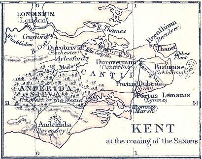
| Beschrijving | Map of "Kent at the coming of the Saxons" |
| Datum | |
| Bron | A School Atlas Of English History, Longmans, Green, 1892 |
| Auteur | S. R. Gardiner (d. 1902) |
Licentie
|
Dit werk bevindt zich in het publiek domein in landen en gebieden waar de auteursrechttermijn het leven van de auteur plus 100 jaar of minder is. | |
| Van dit bestand is vastgesteld dat er geen bekende auteursrechtaanspraken op rusten, alle aanverwante en naburige rechten daarbij inbegrepen. | |
Bestandsgeschiedenis
Klik op een datum/tijd om het bestand te zien zoals het destijds was.
| Datum/tijd | Miniatuur | Afmetingen | Gebruiker | Opmerking | |
|---|---|---|---|---|---|
| huidige versie | 6 jun 2008 23:20 | | 410 × 324 (90 kB) | Nortonius | {{Information |Description=Map of "Kent at the coming of the Saxons" |Source=''A School Atlas Of English History'' |Date=1892 |Author=S. R. Gardiner |Permission= |other_versions= }} |
Bestandsgebruik
Dit bestand wordt op de volgende 3 pagina's gebruikt:
Globaal bestandsgebruik
De volgende andere wiki's gebruiken dit bestand:
- Gebruikt op azb.wikipedia.org
- Gebruikt op br.wikipedia.org
- Gebruikt op ca.wikipedia.org
- Gebruikt op cs.wikipedia.org
- Gebruikt op de.wikipedia.org
- Gebruikt op en.wikipedia.org
- Gebruikt op eo.wikipedia.org
- Gebruikt op fr.wikipedia.org
- Gebruikt op it.wikipedia.org
- Gebruikt op no.wikipedia.org
- Gebruikt op sk.wikipedia.org
- Gebruikt op www.wikidata.org