
Bestand:Ordnance Survey 1-250000 - TF.jpg

Grootte van deze voorvertoning: 600 × 600 pixels. Andere resoluties: 240 × 240 pixels | 480 × 480 pixels | 768 × 768 pixels | 1.024 × 1.024 pixels | 2.048 × 2.048 pixels | 4.000 × 4.000 pixels.
Oorspronkelijk bestand (4.000 × 4.000 pixels, bestandsgrootte: 6,07 MB, MIME-type: image/jpeg)
| Dit is een bestand van Wikimedia Commons. Onderstaande beschrijving komt van de beschrijving van het bestand daar. |
Beschrijving
| Beschrijving |
Español: Un mapa de la Ordnance Survey de la zona TF del sistema de referencia británico, en una escala de 1:250.000. Français : Une carte de l'Ordnance Survey de la zone TF dans le système de référence britanique, à l'échelle 1:250.000. Italiano: Una carta della Ordnance Survey della zona TF nella sistema di referenza britannica, con la scala 1:250.000.     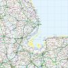     |
| Datum | 6 juni 2010 (uploaddatum) |
| Bron | Ordnance Survey OpenData 1:250 000 Scale Colour Raster. Converted from File:Ordnance Survey 1-250000 - TF.tif to jpg |
| Auteur | Ordnance Survey |
Licentie
Dit bestand valt onder de Ordnance Survey van de Verenigd Koninkrijk onder de OS OpenData License. In het kort: u kunt het bestand vrij verspreiden en bewerken onder de voorwaarde dat u de Ordnance Survey en het jaar vermeldt.
Naamsvermelding: Contains Ordnance Survey data © Crown copyright and database right (year) Opmerking: Afgeleide werken kunnen vrijgegeven worden onder elke Creative Commons Naamsvermelding 3.0 Licentie. |
_(St_Edwards_Crown).svg)
|
This file is licensed under the United Kingdom Open Government Licence v3.0. |
See also: Meta for information on usage on Wikimedia wikis.
|
Bestandsgeschiedenis
Klik op een datum/tijd om het bestand te zien zoals het destijds was.
| Datum/tijd | Miniatuur | Afmetingen | Gebruiker | Opmerking | |
|---|---|---|---|---|---|
| huidige versie | 6 jun 2010 21:49 | | 4.000 × 4.000 (6,07 MB) | OrdnanceSurveyBot | {{subst:Commons:Batch uploading/Ordnance Survey/Template |subst=subst: |square=TF |scale=250.000 |sourcename=1:250 000 Scale Colour Raster |basefilename=Ordnance Survey 1-250000 - |extension=jpg |nw_square=SE |n_square=TA |ne_square= |w_square=SK |e_squa |
Bestandsgebruik
Dit bestand wordt op de volgende pagina gebruikt:
Globaal bestandsgebruik
De volgende andere wiki's gebruiken dit bestand:
- Gebruikt op cy.wikipedia.org
- Gebruikt op en.wikipedia.org
- Ordnance Survey National Grid
- Metrication in the United Kingdom
- Ordnance Survey
- Wikipedia:Featured picture candidates/April-2010
- Wikipedia:Featured picture candidates/National Grid square TF at 1 in 250 000 scale.jpg
- User:Cmglee/Ordnance Survey 1:250 000 Scale Colour Raster map
- User:Peter Mercator/Draft for OS national grid
- Gebruikt op fr.wikipedia.org
- Gebruikt op id.wikipedia.org
- Gebruikt op pl.wikipedia.org