
Bestand:Ouachita Mountains topographic v1.svg

Afmetingen van deze voorvertoning van het type PNG van dit SVG-bestand: 800 × 376 pixels Andere resoluties: 320 × 150 pixels | 640 × 301 pixels | 1.024 × 481 pixels | 1.280 × 601 pixels | 2.560 × 1.202 pixels | 1.535 × 721 pixels.
Oorspronkelijk bestand (SVG-bestand, nominaal 1.535 × 721 pixels, bestandsgrootte: 10,42 MB)
| Dit is een bestand van Wikimedia Commons. Onderstaande beschrijving komt van de beschrijving van het bestand daar. |
Beschrijving
| Beschrijving |
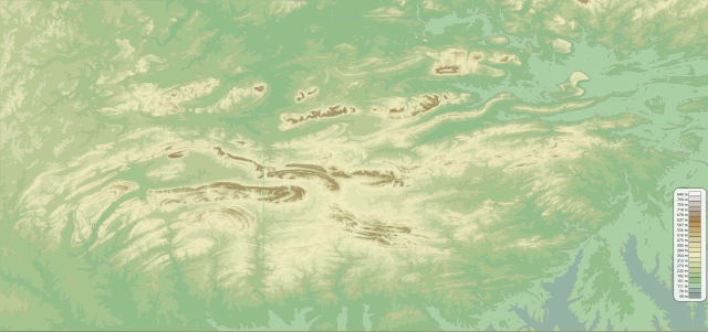
English: Topographic map of the Ouachita Mountains in the U.S. states of Arkansas and Oklahoma.
|
| Datum | |
| Bron | Eigen werk |
| Auteur | Kbh3rd |
Licentie
Ik, de auteursrechthebbende van dit werk, maak het hierbij onder de volgende licenties beschikbaar:
Dit bestand is gelicenseerd onder de Creative Commons-licentie Naamsvermelding-Gelijk delen 3.0 Unported
- De gebruiker mag:
- Delen – het werk kopiëren, verspreiden en doorgeven
- Remixen – afgeleide werken maken
- Onder de volgende voorwaarden:
- naamsvermelding – U moet op een gepaste manier aan naamsvermelding doen, een link naar de licentie geven, en aangeven of er wijzigingen in het werk zijn aangebracht. U mag dit op elke redelijke manier doen, maar niet zodanig dat de indruk wordt gewekt dat de licentiegever instemt met uw werk of uw gebruik van zijn werk.
- Gelijk delen – Als u het werk heeft geremixt, veranderd, of erop heeft voortgebouwd, moet u het gewijzigde materiaal verspreiden onder dezelfde licentie als het oorspronkelijke werk, of een daarmee compatibele licentie.

|
Toestemming wordt verleend voor het kopiëren, verspreiden en/of wijzigen van dit document onder de voorwaarden van de GNU-licentie voor vrije documentatie, versie 1.2 of enige latere versie als gepubliceerd door de Free Software Foundation; zonder Invariant Sections, zonder Front-Cover Texts, en zonder Back-Cover Texts. Een kopie van de licentie is opgenomen in de sectie GNU-licentie voor vrije documentatie. |
U mag zelf één van de licenties kiezen.
Bestandsgeschiedenis
Klik op een datum/tijd om het bestand te zien zoals het destijds was.
| Datum/tijd | Miniatuur | Afmetingen | Gebruiker | Opmerking | |
|---|---|---|---|---|---|
| huidige versie | 22 mei 2010 07:18 | | 1.535 × 721 (10,42 MB) | Kbh3rd | {{Information |Description={{en|1=Topographic map of the Ouachita Mountains in the U.S. states of Arkansas and Oklahoma. Produced with [[:en:Public domain|public domain] |
Bestandsgebruik
Dit bestand wordt op de volgende pagina gebruikt:
Globaal bestandsgebruik
De volgende andere wiki's gebruiken dit bestand:
- Gebruikt op cs.wikipedia.org
- Gebruikt op de.wikipedia.org
- Gebruikt op en.wikipedia.org
- Gebruikt op eo.wikipedia.org
- Gebruikt op es.wikipedia.org
- Gebruikt op frr.wikipedia.org
- Gebruikt op fr.wikipedia.org
- Gebruikt op pl.wikipedia.org
- Gebruikt op simple.wikipedia.org