
Bestand:Pineridgereservationmap.png
Geen hogere resolutie beschikbaar.
Pineridgereservationmap.png (493 × 379 pixels, bestandsgrootte: 71 kB, MIME-type: image/png)
| Dit is een bestand van Wikimedia Commons. Onderstaande beschrijving komt van de beschrijving van het bestand daar. |

|
Deze kaartafbeelding zou opnieuw moeten worden aangemaakt als een SVG-bestand door vectorafbeeldingen te gebruiken. Dit heeft een aantal voordelen; zie Commons:Media for cleanup voor meer informatie. Als er een SVG-formaat van deze afbeelding bestaat, dan deze graag uploaden. Nadat u dit heeft gedaan, gelieve dit sjabloon te vervangen door het sjabloon {{vector version available|nieuwe bestandsnaam.svg}} op deze afbeeldingspagina.
|
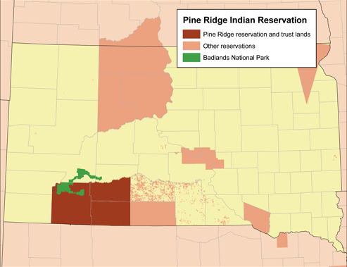
| Beschrijving | Map of the Pine Ridge Indian Reservation. |
| Datum | |
| Bron | Eigen werk (Originele tekst: Self-made using the National Atlas.) |
| Auteur | Kmusser |
Licentie
Kmusser, de auteursrechthebbende van dit werk, maakt het hierbij onder de volgende licentie beschikbaar:
Dit bestand is gelicenseerd onder de Creative Commons-licentie Naamsvermelding-Gelijk delen 2.5 Unported
Naamsvermelding: Kmusser
- De gebruiker mag:
- Delen – het werk kopiëren, verspreiden en doorgeven
- Remixen – afgeleide werken maken
- Onder de volgende voorwaarden:
- naamsvermelding – U moet op een gepaste manier aan naamsvermelding doen, een link naar de licentie geven, en aangeven of er wijzigingen in het werk zijn aangebracht. U mag dit op elke redelijke manier doen, maar niet zodanig dat de indruk wordt gewekt dat de licentiegever instemt met uw werk of uw gebruik van zijn werk.
- Gelijk delen – Als u het werk heeft geremixt, veranderd, of erop heeft voortgebouwd, moet u het gewijzigde materiaal verspreiden onder dezelfde licentie als het oorspronkelijke werk, of een daarmee compatibele licentie.
Bestandsgeschiedenis
Klik op een datum/tijd om het bestand te zien zoals het destijds was.
| Datum/tijd | Miniatuur | Afmetingen | Gebruiker | Opmerking | |
|---|---|---|---|---|---|
| huidige versie | 6 nov 2019 23:09 | | 493 × 379 (71 kB) | Kmusser | crop and add the rest of Bennett county |
| 19 mrt 2008 19:57 |  | 500 × 387 (82 kB) | Kmusser | added Badlands | |
| 19 mrt 2008 19:43 |  | 500 × 389 (79 kB) | Kmusser | {{Information |Description=Map of the Pine Ridge Indian Reservation. |Source=Self-made using the National Atlas. |Date=March 19,2008 |Author= Kmusser |Permi |
Bestandsgebruik
Dit bestand wordt op de volgende pagina gebruikt:
Globaal bestandsgebruik
De volgende andere wiki's gebruiken dit bestand:
- Gebruikt op ar.wikipedia.org
- Gebruikt op ca.wikipedia.org
- Gebruikt op cs.wikipedia.org
- Gebruikt op de.wikipedia.org
- Gebruikt op en.wikipedia.org
- Gebruikt op eo.wikipedia.org
- Gebruikt op fr.wikipedia.org
- Gebruikt op gl.wikipedia.org
- Gebruikt op pl.wikipedia.org
- Gebruikt op uk.wikipedia.org
- Gebruikt op www.wikidata.org