
Bestand:Relief Map of North Ossetia.png

Grootte van deze voorvertoning: 550 × 599 pixels. Andere resoluties: 220 × 240 pixels | 441 × 480 pixels | 1.000 × 1.089 pixels.
Oorspronkelijk bestand (1.000 × 1.089 pixels, bestandsgrootte: 1,66 MB, MIME-type: image/png)
| Dit is een bestand van Wikimedia Commons. Onderstaande beschrijving komt van de beschrijving van het bestand daar. |
Beschrijving
| Beschrijving |
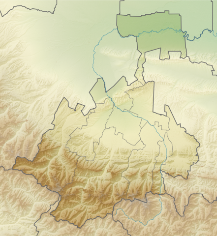
Русский: Физическая карта Республики Северная Осетия-Алания Равноугольная проекция. Координаты краёв:
|
| Datum | |
| Bron | |
| Auteur | Виктор В |
| Andere versies |
[] |


Licentie
| Ik, de auteursrechthebbende van dit werk, geef dit werk vrij in het publieke domein. Dit is wereldwijd van toepassing. In sommige landen is dit wettelijk niet mogelijk; in die gevallen geldt: Ik sta iedereen toe dit werk voor eender welk doel te gebruiken, zonder enige voorwaarden, tenzij zulke voorwaarden door de wet worden voorgeschreven. |
Bestandsgeschiedenis
Klik op een datum/tijd om het bestand te zien zoals het destijds was.
| Datum/tijd | Miniatuur | Afmetingen | Gebruiker | Opmerking | |
|---|---|---|---|---|---|
| huidige versie | 16 aug 2010 18:30 | | 1.000 × 1.089 (1,66 MB) | Виктор В | == {{int:filedesc}} == {{Information |Description={{ru|1=Физическая карта Республики Северная Осетия-Алания<br\>Равноугольная проекция. Координаты краёв: * север — 43. |
Bestandsgebruik
Dit bestand wordt op de volgende pagina gebruikt:
Globaal bestandsgebruik
De volgende andere wiki's gebruiken dit bestand:
- Gebruikt op ba.wikipedia.org
- Gebruikt op be.wikipedia.org
- Gebruikt op bg.wikipedia.org
- Gebruikt op ce.wikipedia.org
- Gebruikt op cs.wikipedia.org
- Gebruikt op da.wikipedia.org
- Gebruikt op de.wikipedia.org
- Gebruikt op eo.wikipedia.org
- Beslano
- Ŝablono:Geokesto lokumilo Nord-Osetio
- Ŝablono:Situo sur mapo Ruslando Nord-Osetio
- Sunaisma moskeo de Vladikavkaz
- Ĉeurba distrikto (Nord-Osetio)
- Distrikto Alagir
- Distrikto Ardon
- Distrikto Digora
- Distrikto Iraf
- Distrikto Kirov (Nord-Osetio)
- Distrikto Mozdok
- Dekstraborda distrikto (Nord-Osetio)
- Gebruikt op es.wikipedia.org
- Gebruikt op fi.wikipedia.org
- Gebruikt op frr.wikipedia.org
- Gebruikt op fr.wikipedia.org
Globaal gebruik van dit bestand bekijken.