
Bestand:Remote Sprint Launch Site No 2.jpg
Grootte van deze voorvertoning: 750 × 600 pixels. Andere resoluties: 300 × 240 pixels | 601 × 480 pixels | 961 × 768 pixels | 1.280 × 1.023 pixels | 2.560 × 2.046 pixels | 4.535 × 3.625 pixels.
Oorspronkelijk bestand (4.535 × 3.625 pixels, bestandsgrootte: 4,4 MB, MIME-type: image/jpeg)
Dit is een bestand van Wikimedia Commons.
Onderstaande beschrijving komt van de beschrijving van het bestand daar.
Onderstaande beschrijving komt van de beschrijving van het bestand daar.
Beschrijving
| Beschrijving |
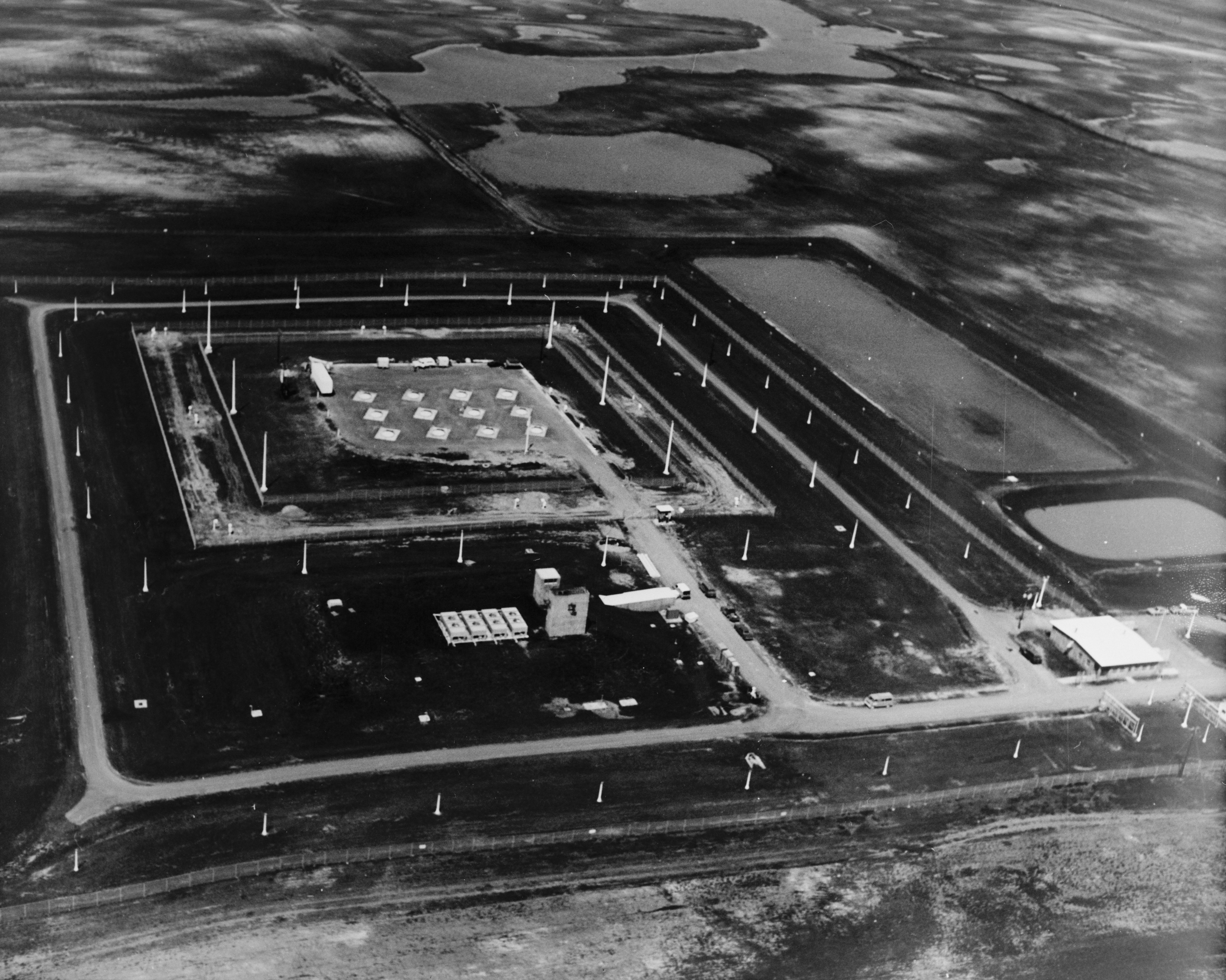
English: Stanley R. Mickelsen Safeguard Complex, Remote Sprint Launch Site No. 2, West of Mile Marker 220 on State Route 1, 6.0 mile, Nekoma vicinity, Cavalier County, ND
|
| Bron | Library of Congress, Prints and Photograph Division, Historic American Engineering Record: HAER ND-9-X-3 |
| Auteur | Onbekend |
Licentie
| Dit beeld- of mediabestand bevat materiaal gebaseerd op een werk van een National Park Service medewerker, gemaakt als onderdeel van de officiële taken van die persoon. Als een werk van de Amerikaanse federale overheid, bevindt dergelijk werk zich in het publieke domein in de Verenigde Staten. Zie de NPS website en NPS copyright policy voor meer informatie. |
|

|
Dit bestand is beschikbaar in de Prints and Photographs division van de Library of Congress
via digitaal ID hhh.nd0086. Deze banner zegt niets over de auteursrechten die van toepassing zijn. Een normale auteursrechten-tag is nodig. Zie Commons:Licensing voor meer informatie.
|
Bestandsgeschiedenis
Klik op een datum/tijd om het bestand te zien zoals het destijds was.
| Datum/tijd | Miniatuur | Afmetingen | Gebruiker | Opmerking | |
|---|---|---|---|---|---|
| huidige versie | 2 mei 2009 23:42 | | 4.535 × 3.625 (4,4 MB) | Cropbot | upload cropped version, operated by User:Finavon. Summary: border cropped |
| 13 okt 2007 06:20 |  | 4.827 × 3.893 (4,62 MB) | Dual Freq | {{Information |Description=Stanley R. Mickelsen Safeguard Complex, Remote Sprint Launch Site No. 2, West of Mile Marker 220 on State Route 1, 6.0 miles North of Langdon, ND, Nekoma vicinity, Cavalier County, ND. (HAER ND-9-X) |Source=[http://memory.loc.go |
Bestandsgebruik
Dit bestand wordt op de volgende pagina gebruikt:
Globaal bestandsgebruik
De volgende andere wiki's gebruiken dit bestand:
- Gebruikt op en.wikipedia.org
- Gebruikt op fr.wikipedia.org
- Gebruikt op ja.wikipedia.org
- Gebruikt op ru.wikipedia.org