
Bestand:Roanoke NASA World Wind.jpg

Grootte van deze voorvertoning: 800 × 592 pixels. Andere resoluties: 320 × 237 pixels | 640 × 474 pixels | 1.024 × 758 pixels | 1.280 × 948 pixels | 1.383 × 1.024 pixels.
Oorspronkelijk bestand (1.383 × 1.024 pixels, bestandsgrootte: 1,26 MB, MIME-type: image/jpeg)
| Dit is een bestand van Wikimedia Commons. Onderstaande beschrijving komt van de beschrijving van het bestand daar. |
Beschrijving
| Beschrijving |
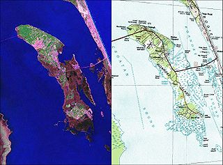
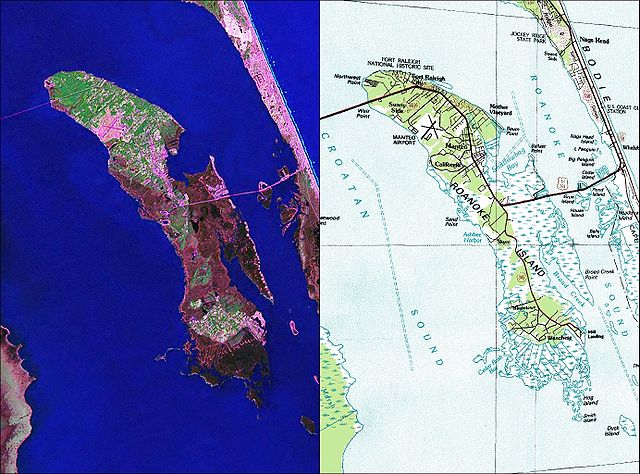
English: NASA World Wind Geocover 2000 and topographic map coverage of Roanoke Island, North Carolina |
| Datum | jaren 2000 |
| Bron | NASA World Wind Screen Shot |
| Auteur | NASA |
Licentie
Deze afbeelding bevindt zich in het publiek domein omdat het materiaal bevat dat oorspronkelijk afkomstig is van de United States Geological Survey, een agentschap van de United States Department of the Interior. Voor meer informatie, zie het officiële USGS-auteursrechtenbeleid
|
Bestandsgeschiedenis
Klik op een datum/tijd om het bestand te zien zoals het destijds was.
| Datum/tijd | Miniatuur | Afmetingen | Gebruiker | Opmerking | |
|---|---|---|---|---|---|
| huidige versie | 26 mei 2010 14:35 | | 1.383 × 1.024 (1,26 MB) | Ratzer | {{Information |Description={{en|1=NASA World Wind Geocover 2000 and topographic map coverage of Roanoke Island, North Carolina}} |Source=NASA World Wind Screen Shot |Author=NASA |Date=2000s |Permission= |other_versions= }} [[Category:Maps of North Caroli |
Bestandsgebruik
Dit bestand wordt op de volgende pagina gebruikt:
Globaal bestandsgebruik
De volgende andere wiki's gebruiken dit bestand:
- Gebruikt op ca.wikipedia.org
- Gebruikt op ceb.wikipedia.org
- Gebruikt op de.wikipedia.org
- Gebruikt op en.wikipedia.org
- Gebruikt op eo.wikipedia.org
- Gebruikt op es.wikipedia.org
- Gebruikt op hu.wikipedia.org
- Gebruikt op ja.wikipedia.org
- Gebruikt op ko.wikipedia.org
- Gebruikt op pl.wikipedia.org
- Gebruikt op pt.wikipedia.org
- Gebruikt op ru.wikipedia.org
- Gebruikt op www.wikidata.org
- Gebruikt op zh.wikipedia.org