
Bestand:Satellitenbild Niederrheinische Bucht.png
Grootte van deze voorvertoning: 717 × 600 pixels. Andere resoluties: 287 × 240 pixels | 574 × 480 pixels | 918 × 768 pixels | 1.225 × 1.024 pixels | 1.625 × 1.359 pixels.
Oorspronkelijk bestand (1.625 × 1.359 pixels, bestandsgrootte: 3,71 MB, MIME-type: image/png)
| Dit is een bestand van Wikimedia Commons. Onderstaande beschrijving komt van de beschrijving van het bestand daar. |
| Beschrijving |
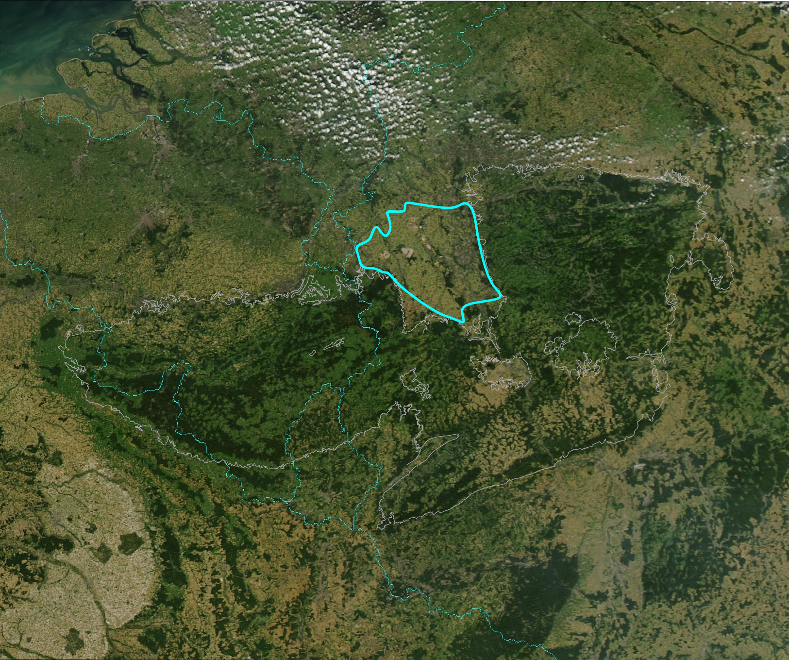
English: Outline of the Niederrheinische Bucht (fat line) on satellite image of Rheinisches Schiefergebirge (grey outline). Boundaries of Germany (right), the Netherlands (top), Belgium (upper left), France (lower left) and Luxemburg (lower center) for orientation (cyan).
Deutsch: Die Niederrheinische Bucht (fette Linie) auf einem Satellitenbild des Rheinischen Schiefergebirges (grauer Umriss). Die Grenzen von Deutschland (rechts), der Niederlande (links oben), Belgiens (obere Bildhälfte links), Frankreichs (untere Bildhälfte links) und Luxemburgs (untere Bildmitte) zur Orientierung (cyan). |
| Datum | |
| Bron | Image:RSG-NASA-250.jpg, Detail of Image:Europe-NW-A2002256.1250.250m.jpg. Niederrheinische Bucht: Schmitt, Eckart et al. (1975): Harms Handbuch der Geographie - Deutschland. 26. Auflage, Paul List Verlag, München, 432 S. ISBN 3-471-18803-7 |
| Auteur | drawn by Jo Weber on PD-image Image:RSG-NASA-250.jpg |
| Toestemming (Hergebruik van dit bestand) |
Additional PD-user for the outline drawing. Original satellite picture is PD-USGov-NASA. See below. |
| Andere versies | Image:RSG-NASA-250 Ausschnitt mit Umriss.jpg, Image:RSG-NASA-250.jpg |
| Dit bestand bevindt zich in het publiek domein, omdat het gemaakt is door de NASA. In de reproductierichtlijnen van de NASA staat dat "NASA-materiaal niet beschermd wordt door auteursrecht, tenzij anders vermeld". | ||
 |
Waarschuwingen:
|
| |
Dit bestand is door Jo weber op Wikimedia Commons, in het publieke domein geplaatst. Dit is wereldwijd van toepassing. In sommige landen is dit niet mogelijk; in die gevallen geldt: |
Bestandsgeschiedenis
Klik op een datum/tijd om het bestand te zien zoals het destijds was.
| Datum/tijd | Miniatuur | Afmetingen | Gebruiker | Opmerking | |
|---|---|---|---|---|---|
| huidige versie | 2 mrt 2008 15:01 | | 1.625 × 1.359 (3,71 MB) | Jo Weber | {{Information |Description = Outline of the ''Niederrheinische Bucht''(fat line) on satellite image of Rheinisches Schiefergebirge (grey outline). Boundaries of Germany (right), the Netherlands (top), Belgium (upper lef |
Bestandsgebruik
Dit bestand wordt op de volgende pagina gebruikt:
Globaal bestandsgebruik
De volgende andere wiki's gebruiken dit bestand:
- Gebruikt op de.wikipedia.org
- Gebruikt op en.wikipedia.org