
Bestand:ScotlandSouthAyrshire.png
Geen hogere resolutie beschikbaar.
ScotlandSouthAyrshire.png (200 × 230 pixels, bestandsgrootte: 4 kB, MIME-type: image/png)
| Dit is een bestand van Wikimedia Commons. Onderstaande beschrijving komt van de beschrijving van het bestand daar. |
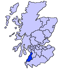
South Ayrshire unitary council
Slightly edited version of a map drawn by Morwen

|
Toestemming wordt verleend voor het kopiëren, verspreiden en/of wijzigen van dit document onder de voorwaarden van de GNU-licentie voor vrije documentatie, versie 1.2 of enige latere versie als gepubliceerd door de Free Software Foundation; zonder Invariant Sections, zonder Front-Cover Texts, en zonder Back-Cover Texts. Een kopie van de licentie is opgenomen in de sectie GNU-licentie voor vrije documentatie. |
| Dit bestand is gelicenseerd onder de Creative Commons-licentie Naamsvermelding-Gelijk delen 3.0 Unported | ||
| ||
| Deze licentietag is toegevoegd aan dit bestand in verband met de GFDL licentie-update. |
Bestandsgeschiedenis
Klik op een datum/tijd om het bestand te zien zoals het destijds was.
| Datum/tijd | Miniatuur | Afmetingen | Gebruiker | Opmerking | |
|---|---|---|---|---|---|
| huidige versie | 17 mei 2005 23:41 | | 200 × 230 (4 kB) | Voyager | |
| 17 mei 2005 23:40 |  | 200 × 230 (4 kB) | Voyager | South Ayrshire unitary council Slightly edited version of a map drawn by Morwen {{GFDL}} Category:Maps of Scottish unitary councils |
Bestandsgebruik
Geen enkele pagina gebruikt dit bestand.
Globaal bestandsgebruik
De volgende andere wiki's gebruiken dit bestand:
- Gebruikt op be.wikipedia.org
- Gebruikt op bg.wikipedia.org
- Gebruikt op cy.wikipedia.org
- Gebruikt op de.wikipedia.org
- Gebruikt op en.wikipedia.org
- Gebruikt op eu.wikipedia.org
- Hegoaldeko Ayrshire
- Ayr
- Lankide:Euskaldunaa
- Maybole
- Prestwick
- Txantiloi:Hegoaldeko Ayrshire
- Wikiproiektu:Irlanda, Gales eta Eskoziako udalerriak
- Alloway
- Girvan
- Troon
- Annbank
- Ballantrae
- Barassie (Hegoaldeko Ayrshire)
- Coylton
- Craigie Udalerria eta Parrokia
- Dundonald (South Ayrshire)
- Failford
- Heronsford
- Joppa (Hegoaldeko Ayrshire)
- Loans (Hegoaldeko Ayrshire)
- Millmannoch
- Monkton (Ayrshire)
- Mossblown
- Old Rome (Hegoaldeko Ayrshire)
- Symington (Hegoaldeko Ayrshire)
- Tarbolton
- Barr (Ayrshire)
- Barrhill (Hegoaldeko Ayrshire)
- Colmonell
- Crosshill (Hegoaldeko Ayrshire)
- Dailly
- Dunure
- Kirkmichael
- Kirkoswald (Hegoaldeko Ayrshire)
- Maidens
- Minishant
- Old Dailly
- Straiton
- Belmont (Ayr)
- Doonfoot
- Montgomerieston
- Heathfield (Hegoaldeko Ayrshire)
- Kincaidston
Globaal gebruik van dit bestand bekijken.