Bestand:Sinai map.PNG

Pagina-inhoud wordt niet ondersteund in andere talen.
Uit Wikipedia, de vrije encyclopedie

Sinai_map.PNG(327 × 350 pixels, bestandsgrootte: 30 kB, MIME-type: image/png)


Beschrijving

Selected maps are included in the  Wikimedia Atlas of Egypt.

See also : Category:Conflicts by country

Beschrijving
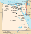
Nederlands: Kaart van Egypte van CIA World Factbook, enkel verkleind, en het Sinai schiereiland met een rode rechthoek aangegeven
English: Map of Egypt from CIA World Factbook, NOT made unreadable, and with a marking of Sinai peninsula
Bron CIA World Factbook
Auteur CIA
Andere versies
Ongoing armed conflicts ( Countries Maps )
National or regional Maps of ongoing insurgencies, armed conflicts, disputes of territories, military conflicts, and also current civil or international wars :

See also:
Category:Conflicts in 2024 (with list of countries in ongoing armed conflicts)
Template:City maps of ongoing civil wars (Local maps)

Ongoing armed conflicts ( Local & City Maps )

Licentie

Public domain
Deze afbeelding bevindt zich in het publiek domein omdat het materiaal bevat dat oorspronkelijk afkomstig is van het CIA World Factbook.

Bahasa Indonesia  čeština  Deutsch  eesti  English  español  Esperanto  français  galego  hrvatski  italiano  Nederlands  norsk nynorsk  polski  português  sicilianu  slovenščina  suomi  Türkçe  Zazaki  беларуская (тарашкевіца)  македонски  русский  српски / srpski  українська  ქართული  বাংলা  தமிழ்  മലയാളം  한국어  日本語  中文  中文(简体)  中文(繁體)  العربية  +/−


Oorspronkelijk uploadlogboek

De oorspronkelijke beschrijving van deze afbeelding stond hier. Alle volgende gebruikersnamen verwijzen naar nl.wikipedia.
  • 2003-10-25 20:45 Flyingbird 175×189× (9503 bytes) Kaart van Egypte van CIA World Factbook, enkel verkleind, en het Sinai schiereiland met een rode rechthoek aangegeven

Bijschriften

Beschrijf in één regel wat dit bestand voorstelt

Items getoond in dit bestand

beeldt af

image/png

Bestandsgeschiedenis

Klik op een datum/tijd om het bestand te zien zoals het destijds was.

Datum/tijdMiniatuurAfmetingenGebruikerOpmerking
huidige versie7 jul 2022 16:33Miniatuurafbeelding voor de versie van 7 jul 2022 16:33327 × 350 (30 kB)Enyavarenglish version (File:Eg-map.png)
7 jul 2022 14:23Miniatuurafbeelding voor de versie van 7 jul 2022 14:23351 × 379 (37 kB)Enyavarreplaced with better version based on File:Egypt sm01.png
11 sep 2019 13:13Miniatuurafbeelding voor de versie van 11 sep 2019 13:13177 × 191 (59 kB)ديفيد عادل وهبة خليل 2{{wikiatlas|Egypt}} '''See also :''' Category:Conflicts by country<br> {{Information |Description={{nl|Kaart van Egypte van CIA World Factbook, enkel verkleind, en het Sinai schiereiland met een rode rechthoek aangegeven}} |Source=CIA World Factbook |Date= |Author=CIA |Permission= |other versions={{Ongoing civil wars (maps)}}<br>{{City maps of ongoing civil wars}} }} == {{int:license-header}} == {{PD-USGov-CIA-WF}} == {{original upload log}} == {{original description page|nl.wikipedia|...

Dit bestand wordt op de volgende pagina gebruikt:

Globaal bestandsgebruik

De volgende andere wiki's gebruiken dit bestand:

Metadata