
Bestand:SpainDueroBasin.png

Grootte van deze voorvertoning: 800 × 572 pixels. Andere resoluties: 320 × 229 pixels | 640 × 457 pixels | 1.024 × 732 pixels | 1.280 × 915 pixels | 1.748 × 1.249 pixels.
Oorspronkelijk bestand (1.748 × 1.249 pixels, bestandsgrootte: 2,55 MB, MIME-type: image/png)
| Dit is een bestand van Wikimedia Commons. Onderstaande beschrijving komt van de beschrijving van het bestand daar. |
Beschrijving
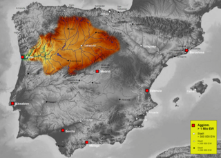
| Beschrijving | Map of Duero river basin in Spain, Karte des hydrogeografischen Beckens des Duero |
| Datum | |
| Bron | Own work, based on an image of http://www.maps-for-free.com/ (Creative Commons Attribution Share Alike 3.0) |
| Auteur | Port(u*o)s |
| Toestemming (Hergebruik van dit bestand) |
Creative Commons Attribution Share Alike 3.0 |
Licentie
Dit bestand is gelicenseerd onder de Creative Commons-licentie Naamsvermelding-Gelijk delen 3.0 Unported
- De gebruiker mag:
- Delen – het werk kopiëren, verspreiden en doorgeven
- Remixen – afgeleide werken maken
- Onder de volgende voorwaarden:
- naamsvermelding – U moet op een gepaste manier aan naamsvermelding doen, een link naar de licentie geven, en aangeven of er wijzigingen in het werk zijn aangebracht. U mag dit op elke redelijke manier doen, maar niet zodanig dat de indruk wordt gewekt dat de licentiegever instemt met uw werk of uw gebruik van zijn werk.
- Gelijk delen – Als u het werk heeft geremixt, veranderd, of erop heeft voortgebouwd, moet u het gewijzigde materiaal verspreiden onder dezelfde licentie als het oorspronkelijke werk, of een daarmee compatibele licentie.
Bestandsgeschiedenis
Klik op een datum/tijd om het bestand te zien zoals het destijds was.
| Datum/tijd | Miniatuur | Afmetingen | Gebruiker | Opmerking | |
|---|---|---|---|---|---|
| huidige versie | 7 okt 2021 18:41 | | 1.748 × 1.249 (2,55 MB) | Lojwe | Santiago mal posicionada |
| 5 feb 2019 03:51 |  | 1.748 × 1.249 (2,11 MB) | TouchName | recorte de marco | |
| 30 okt 2007 04:07 |  | 1.808 × 1.307 (2,57 MB) | Port(u*o)s | == Summary == {{Information |Description=Map of Duero river basin in Spain, Karte des hydrogeografischen Beckens des Duero |Source= Own work, based on an image of http://www.maps-for-free.com/ (Creative Commons Attribution Share Alike 3.0) |Date=October 2 |
Bestandsgebruik
Dit bestand wordt op de volgende pagina gebruikt:
Globaal bestandsgebruik
De volgende andere wiki's gebruiken dit bestand:
- Gebruikt op af.wikipedia.org
- Gebruikt op ast.wikipedia.org
- Gebruikt op ca.wikipedia.org
- Gebruikt op cs.wikipedia.org
- Gebruikt op cv.wikipedia.org
- Gebruikt op de.wikipedia.org
- Gebruikt op el.wikipedia.org
- Gebruikt op eo.wikipedia.org
- Gebruikt op es.wikipedia.org
- Duero
- Río Carrión
- Pisuerga
- Eresma
- Adaja
- Río Arlanza
- Río Aliste
- Río Tera
- Río Zapardiel
- Río Guareña
- Río Huebra
- Río Jerga
- Úrbel
- Voltoya
- Río Duratón
- Río Margañán
- Anexo:Ríos de España
- Usuario discusión:NACLE
- Río Malo
- Cuenca hidrográfica del Duero
- Río Valdeginate
- Río Almar
- Río Grande (afluente del Carrión)
- Río Arevalillo
- Plantilla:Ficha de cuerpo de agua
- Plantilla:Ficha de cuerpo de agua/doc
- Río Negro (afluente del Omaña)
- Río Navajos
- Río Valdesamario
- Río Castro (afluente del Tera)
- Río Manzanas
- Río Tuela
- Río Gamoneda
- Río Truchas
- Río Cueza
Globaal gebruik van dit bestand bekijken.