
Bestand:Stanford-linear-accelerator-usgs-ortho-kaminski-5900.jpg
Grootte van deze voorvertoning: 800 × 201 pixels. Andere resoluties: 320 × 80 pixels | 640 × 161 pixels | 1.024 × 257 pixels | 1.280 × 321 pixels | 5.900 × 1.480 pixels.
Oorspronkelijk bestand (5.900 × 1.480 pixels, bestandsgrootte: 1,88 MB, MIME-type: image/jpeg)
| Dit is een bestand van Wikimedia Commons. Onderstaande beschrijving komt van de beschrijving van het bestand daar. |
Beschrijving
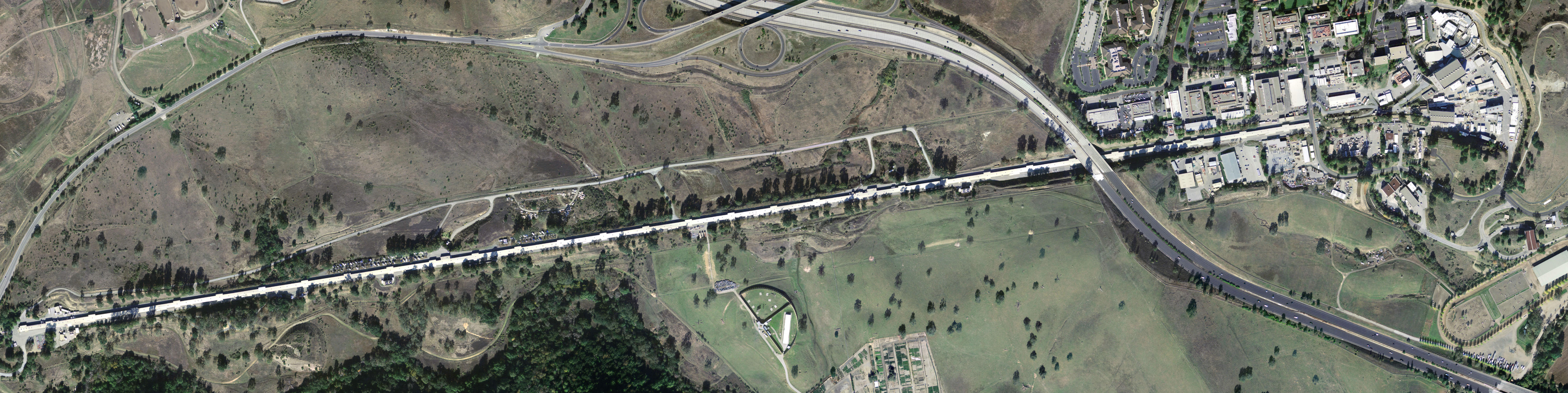
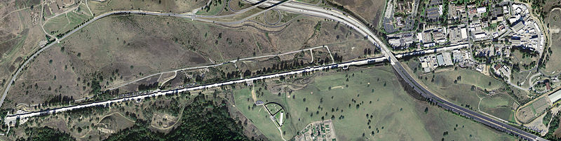
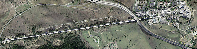
| Beschrijving | Stanford Linear Accelerator, shown in an aerial digital orthoimage. The two roads seen near the accelerator are California Interstate 280 (to the East) and Sand Hill Road (along the Northwest). |
| Datum | |
| Bron | United States Geological Survey |
| Auteur | Peter Kaminski |
Licentie
Deze afbeelding bevindt zich in het publiek domein omdat het materiaal bevat dat oorspronkelijk afkomstig is van de United States Geological Survey, een agentschap van de United States Department of the Interior. Voor meer informatie, zie het officiële USGS-auteursrechtenbeleid
|
Bestandsgeschiedenis
Klik op een datum/tijd om het bestand te zien zoals het destijds was.
| Datum/tijd | Miniatuur | Afmetingen | Gebruiker | Opmerking | |
|---|---|---|---|---|---|
| huidige versie | 8 mei 2005 09:56 | 5.900 × 1.480 (1,88 MB) | Floriang | Stanford Linear Accelerator, shown in an aerial digital orthoimage. Image data acquired 2004-02-27 by the United States Geological Survey. This image created by Peter Kaminski, 2004-12-19 and uploaded in the public domain. {{ |
Bestandsgebruik
Dit bestand wordt op de volgende pagina gebruikt:
Globaal bestandsgebruik
De volgende andere wiki's gebruiken dit bestand:
- Gebruikt op ar.wikipedia.org
- Gebruikt op ca.wikipedia.org
- Gebruikt op cs.wikipedia.org
- Gebruikt op de.wikipedia.org
- Gebruikt op en.wikipedia.org
- SLAC National Accelerator Laboratory
- Electron scattering
- John Duncan (artist)
- List of Historic Mechanical Engineering Landmarks
- Portal talk:California
- User:Cullen328/sandbox/Stanford
- User:IndianFace/sandbox
- Portal:San Francisco Bay Area/Years/Archive
- Portal:San Francisco Bay Area/Years/53
- Timeline of the San Francisco Bay Area
- Gebruikt op en.wikibooks.org
- Gebruikt op es.wikipedia.org
- Gebruikt op fi.wikipedia.org
- Gebruikt op fr.wikipedia.org
- Gebruikt op hu.wikipedia.org
- Gebruikt op it.wikipedia.org
- Gebruikt op ja.wikipedia.org
- Gebruikt op ko.wikipedia.org
- Gebruikt op la.wikipedia.org
- Gebruikt op lt.wikipedia.org
- Gebruikt op nn.wikipedia.org
- Gebruikt op pl.wikipedia.org
- Gebruikt op pt.wikipedia.org
- Gebruikt op ro.wikipedia.org
- Gebruikt op ru.wikipedia.org
- Gebruikt op sk.wikipedia.org
- Gebruikt op sv.wikipedia.org
- Gebruikt op tr.wikipedia.org
- Gebruikt op uk.wikipedia.org
- Gebruikt op ur.wikipedia.org