
Bestand:Statehood quarters map 2009.svg

Afmetingen van deze voorvertoning van het type PNG van dit SVG-bestand: 800 × 495 pixels Andere resoluties: 320 × 198 pixels | 640 × 396 pixels | 1.024 × 633 pixels | 1.280 × 791 pixels | 2.560 × 1.583 pixels | 959 × 593 pixels.
Oorspronkelijk bestand (SVG-bestand, nominaal 959 × 593 pixels, bestandsgrootte: 113 kB)
| Dit is een bestand van Wikimedia Commons. Onderstaande beschrijving komt van de beschrijving van het bestand daar. |
Beschrijving
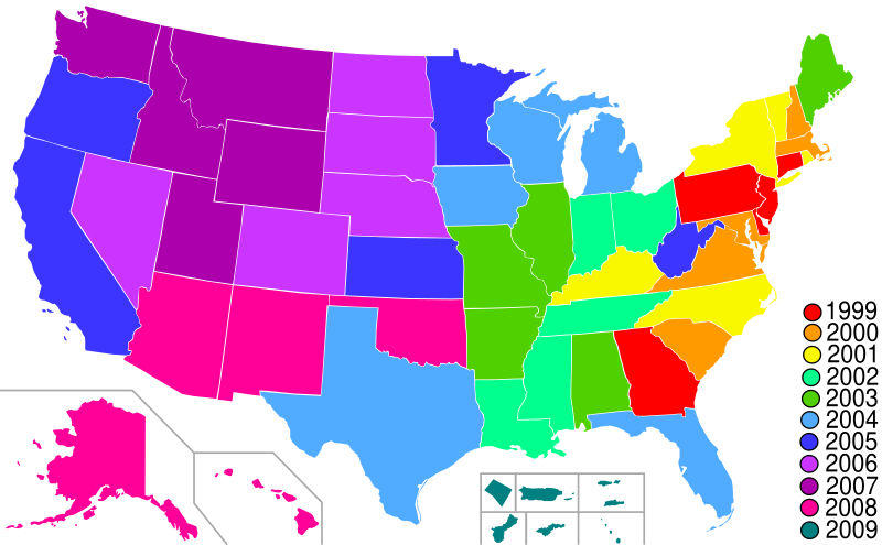
| Beschrijving | Map of Statehood quarters with the 2009 issues |
| Datum | |
| Bron | base map is Lokal_Profil's blank map of US with territories; color scheme and the key is from the png version of this map by me. Guam has been redone based on Image:Guam-CIA WFB Map.png. American Samoa has been added based on Image:American Samoa-CIA WFB Map.png |
| Auteur | Hoshie |
Licentie
Ik, de auteursrechthebbende van dit werk, maak het hierbij onder de volgende licentie beschikbaar:

|
Toestemming wordt verleend voor het kopiëren, verspreiden en/of wijzigen van dit document onder de voorwaarden van de GNU-licentie voor vrije documentatie, versie 1.2 of enige latere versie als gepubliceerd door de Free Software Foundation; zonder Invariant Sections, zonder Front-Cover Texts, en zonder Back-Cover Texts. Een kopie van de licentie is opgenomen in de sectie GNU-licentie voor vrije documentatie. |
| Dit bestand is gelicenseerd onder de Creative Commons-licentie Naamsvermelding-Gelijk delen 3.0 Unported | ||
| ||
| Deze licentietag is toegevoegd aan dit bestand in verband met de GFDL licentie-update. |
Bestandsgeschiedenis
Klik op een datum/tijd om het bestand te zien zoals het destijds was.
| Datum/tijd | Miniatuur | Afmetingen | Gebruiker | Opmerking | |
|---|---|---|---|---|---|
| huidige versie | 30 jan 2009 04:28 | | 959 × 593 (113 kB) | Hoshie | move DC inset to the bottom with the others |
| 19 jan 2009 01:33 |  | 959 × 593 (112 kB) | Hoshie | Made DC an inset; fixed Tutuila (American Samoa) | |
| 13 jan 2009 07:08 |  | 959 × 593 (112 kB) | Hoshie | {{Information |Description=Map of Statehood quarters with the 2009 issues |Source=base map is Lokal_Profil's blank map of US with territories; color scheme and the key is from the [[:Image:Stat |
Bestandsgebruik
Dit bestand wordt op de volgende pagina gebruikt:
Globaal bestandsgebruik
De volgende andere wiki's gebruiken dit bestand:
- Gebruikt op ar.wikipedia.org
- Gebruikt op de.wikipedia.org
- Gebruikt op en.wikipedia.org
- Gebruikt op es.wikipedia.org
- Gebruikt op fr.wikipedia.org
- Gebruikt op gl.wikipedia.org
- Gebruikt op it.wikipedia.org
- Gebruikt op ja.wikipedia.org
- Gebruikt op ko.wikipedia.org
- Gebruikt op ru.wikipedia.org
- Gebruikt op uk.wikipedia.org
- Gebruikt op zh.wikipedia.org