
Bestand:Tassili n'Ajjer Landsat.jpg

Grootte van deze voorvertoning: 750 × 600 pixels. Andere resoluties: 300 × 240 pixels | 600 × 480 pixels | 960 × 768 pixels | 1.280 × 1.024 pixels.
Oorspronkelijk bestand (1.280 × 1.024 pixels, bestandsgrootte: 1,2 MB, MIME-type: image/jpeg)
| Dit is een bestand van Wikimedia Commons. Onderstaande beschrijving komt van de beschrijving van het bestand daar. |
| Beschrijving |
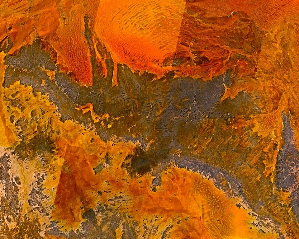
English: Tassili n'Ajjer massif in the Sahara, Algeria. |
| Datum | |
| Bron |
Made with The GIMP! from a NASA World Wind screenshot.
|
| Auteur | Júlio Reis (User:Tintazul) |
| Toestemming (Hergebruik van dit bestand) |
I, the author release this image into Public Domain. |
| Deze afbeelding bevindt zich in het publiek domein omdat het een screenshot is van NASA’s software World Wind die gebruik maakt van een publiek domein-laag, zoals Blue Marble, MODIS, Landsat, SRTM, USGS of GLOBE.
|
 |
Bestandsgeschiedenis
Klik op een datum/tijd om het bestand te zien zoals het destijds was.
| Datum/tijd | Miniatuur | Afmetingen | Gebruiker | Opmerking | |
|---|---|---|---|---|---|
| huidige versie | 3 nov 2005 18:48 | | 1.280 × 1.024 (1,2 MB) | Tintazul | {{Information| |Description=Tassili n'Ajjer massif in the Sahara, Algeria. |Source=Made with [http://www.gimp.org/ The GIMP!] from a [http://worldwind.arc.nasa.gov/ NASA World Wind] screenshot |Date=03 November 2005 |Author=Júlio Reis (User:Tintazul) |
Bestandsgebruik
Dit bestand wordt op de volgende pagina gebruikt:
Globaal bestandsgebruik
De volgende andere wiki's gebruiken dit bestand:
- Gebruikt op ast.wikipedia.org
- Gebruikt op be.wikipedia.org
- Gebruikt op bg.wikipedia.org
- Gebruikt op ca.wikipedia.org
- Gebruikt op cs.wikipedia.org
- Gebruikt op de.wikipedia.org
- Gebruikt op eo.wikipedia.org
- Gebruikt op es.wikipedia.org
- Gebruikt op he.wikipedia.org
- Gebruikt op hr.wikipedia.org
- Gebruikt op hy.wikipedia.org
- Gebruikt op ja.wikipedia.org
- Gebruikt op ka.wikipedia.org
- Gebruikt op kk.wikipedia.org
- Gebruikt op nn.wikipedia.org
- Gebruikt op no.wikipedia.org
- Gebruikt op pt.wikipedia.org
- Gebruikt op ru.wikipedia.org
- Gebruikt op sh.wikipedia.org
- Gebruikt op sv.wikipedia.org
- Gebruikt op xmf.wikipedia.org