
Bestand:UAE divisions.jpg
Geen hogere resolutie beschikbaar.
UAE_divisions.jpg (617 × 496 pixels, bestandsgrootte: 96 kB, MIME-type: image/jpeg)
| Dit is een bestand van Wikimedia Commons. Onderstaande beschrijving komt van de beschrijving van het bestand daar. |
Beschrijving

|
Deze kaartafbeelding zou opnieuw moeten worden aangemaakt als een SVG-bestand door vectorafbeeldingen te gebruiken. Dit heeft een aantal voordelen; zie Commons:Media for cleanup voor meer informatie. Als er een SVG-formaat van deze afbeelding bestaat, dan deze graag uploaden. Nadat u dit heeft gedaan, gelieve dit sjabloon te vervangen door het sjabloon {{vector version available|nieuwe bestandsnaam.svg}} op deze afbeeldingspagina.
|


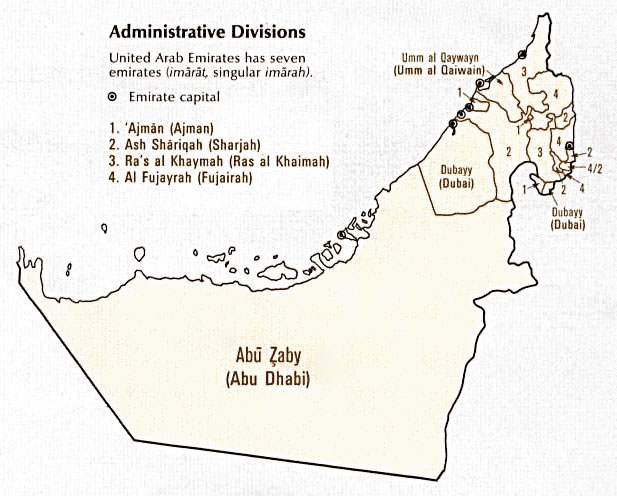
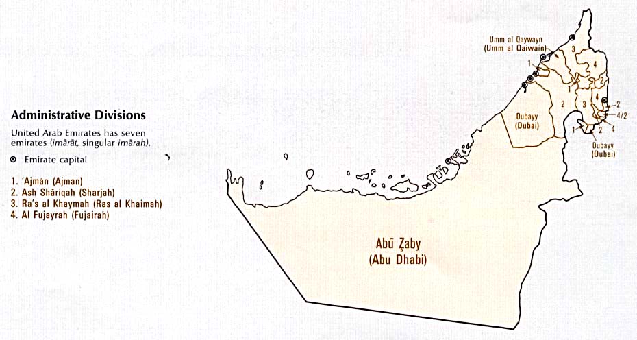
| Beschrijving | A map showing the seven Emirates of the United Arab Emirates. |
| Datum | published January 1993 |
| Bron |
Digital file: http://www.lib.utexas.edu/maps/atlas_middle_east/uae_division.jpg |
| Auteur | U.S. Central Intelligence Agency |
| Toestemming (Hergebruik van dit bestand) |
Public domain |
Licentie
| This image is a work of a Central Intelligence Agency employee, taken or made as part of that person's official duties. As a Work of the United States Government, this image or media is in the public domain in the United States.
|

|
Bestandsgeschiedenis
Klik op een datum/tijd om het bestand te zien zoals het destijds was.
| Datum/tijd | Miniatuur | Afmetingen | Gebruiker | Opmerking | |
|---|---|---|---|---|---|
| huidige versie | 27 okt 2006 14:38 | | 617 × 496 (96 kB) | Conscious | newest version from en: |
| 6 sep 2005 12:53 |  | 930 × 496 (61 kB) | Thryduulf | A map showing the seven Emirates of the United Arab Emirates. Source is [http://www.lib.utexas.edu/maps/atlas_middle_east/uae_division.jpg] which states that "These maps and charts are scanned from ''Atlas of the Middle East'', published in January 1 |
Bestandsgebruik
Dit bestand wordt op de volgende pagina gebruikt:
Globaal bestandsgebruik
De volgende andere wiki's gebruiken dit bestand:
- Gebruikt op azb.wikipedia.org
- Gebruikt op de.wikipedia.org
- Gebruikt op en.wikipedia.org
- Gebruikt op sq.wikipedia.org