
Bestand:Vestmann archipel topographic map-fr.svg

Afmetingen van deze voorvertoning van het type PNG van dit SVG-bestand: 721 × 600 pixels Andere resoluties: 289 × 240 pixels | 577 × 480 pixels | 923 × 768 pixels | 1.231 × 1.024 pixels | 2.462 × 2.048 pixels | 887 × 738 pixels.
Oorspronkelijk bestand (SVG-bestand, nominaal 887 × 738 pixels, bestandsgrootte: 323 kB)
| Dit is een bestand van Wikimedia Commons. Onderstaande beschrijving komt van de beschrijving van het bestand daar. |
Beschrijving
| Beschrijving |
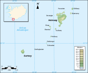
English: French Map of the Vestmannaeyjar.
Français : Carte en français des Îles Vestmann. |
| Datum | |
| Bron |
Travail personnel.
Sources :
Logiciels utilisés :
Autres données :
|
| Auteur | Pinpin |

|
Dit SVG-bestand maakt gebruik van geïntegreerde tekst die gemakkelijk kan worden vertaald naar uw taal met een SVG editor, een tekstverwerker of het hulpmiddel SVG Translate. Uitleg |
Deze niet W3C-verklaarde vectorafbeelding is gemaakt met Inkscape .
Licentie
Ik, de auteursrechthebbende van dit werk, maak het hierbij onder de volgende licenties beschikbaar:

|
Toestemming wordt verleend voor het kopiëren, verspreiden en/of wijzigen van dit document onder de voorwaarden van de GNU-licentie voor vrije documentatie, versie 1.2 of enige latere versie als gepubliceerd door de Free Software Foundation; zonder Invariant Sections, zonder Front-Cover Texts, en zonder Back-Cover Texts. Een kopie van de licentie is opgenomen in de sectie GNU-licentie voor vrije documentatie. |
Dit bestand is gelicenseerd onder de Creative Commons-licenties Naamsvermelding-Gelijk delen 3.0 Unported, 2.5 Algemeen, 2.0 Algemeen en 1.0 Algemeen.
- De gebruiker mag:
- Delen – het werk kopiëren, verspreiden en doorgeven
- Remixen – afgeleide werken maken
- Onder de volgende voorwaarden:
- naamsvermelding – U moet op een gepaste manier aan naamsvermelding doen, een link naar de licentie geven, en aangeven of er wijzigingen in het werk zijn aangebracht. U mag dit op elke redelijke manier doen, maar niet zodanig dat de indruk wordt gewekt dat de licentiegever instemt met uw werk of uw gebruik van zijn werk.
- Gelijk delen – Als u het werk heeft geremixt, veranderd, of erop heeft voortgebouwd, moet u het gewijzigde materiaal verspreiden onder dezelfde licentie als het oorspronkelijke werk, of een daarmee compatibele licentie.
U mag zelf één van de licenties kiezen.
Bestandsgeschiedenis
Klik op een datum/tijd om het bestand te zien zoals het destijds was.
| Datum/tijd | Miniatuur | Afmetingen | Gebruiker | Opmerking | |
|---|---|---|---|---|---|
| huidige versie | 21 dec 2010 02:31 | | 887 × 738 (323 kB) | Krun | Corrected text labels. |
| 7 mrt 2008 19:33 |  | 887 × 738 (323 kB) | Pinpin | == Description == {{Information |Description= {{en| French Map of the Vestmannaeyjar.}} {{fr| Carte en français des Îles Vestmann.}} |Source=Travail personnel. {{clr}} Sources : * Fond de carte : [http://www |
Bestandsgebruik
Geen enkele pagina gebruikt dit bestand.
Globaal bestandsgebruik
De volgende andere wiki's gebruiken dit bestand:
- Gebruikt op ar.wikipedia.org
- Gebruikt op arz.wikipedia.org
- Gebruikt op ca.wikipedia.org
- Gebruikt op es.wikipedia.org
- Gebruikt op fr.wikipedia.org
- Gebruikt op ga.wikipedia.org
- Gebruikt op hr.wikipedia.org
- Gebruikt op hu.wikipedia.org
- Gebruikt op it.wikipedia.org
- Gebruikt op ro.wikipedia.org
- Gebruikt op ru.wikipedia.org
- Gebruikt op sh.wikipedia.org
- Gebruikt op uk.wikipedia.org
- Gebruikt op vi.wikipedia.org
- Gebruikt op www.wikidata.org