
Bestand:Village Sign, Robertsbridge - geograph.org.uk - 1731097.jpg
Village_Sign,_Robertsbridge_-_geograph.org.uk_-_1731097.jpg (640 × 430 pixels, bestandsgrootte: 145 kB, MIME-type: image/jpeg)
| Dit is een bestand van Wikimedia Commons. Onderstaande beschrijving komt van de beschrijving van het bestand daar. |
Beschrijving
| Beschrijving |
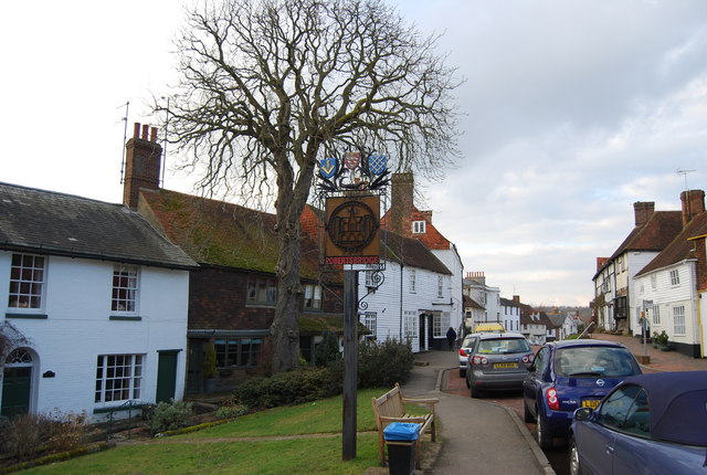
English: Village Sign, Robertsbridge Robertsbridge
Robertsbridge is a village in East Sussex, England within the civil parish of Salehurst and Robertsbridge. It is approximately ten miles (16 km) north of Hastings and thirteen miles (21 km) south-east of Tunbridge Wells. The River Rother passes through the village. The village is thought to date back to 1176 when a Cistercian abbey was founded there by the Abbot, Robert de St Martin. When a market charter was granted in 1198 by Richard I to 'Robertsbridge' (Pons Roberti in Latin) it was the first recorded use of the name. The abbey was dissolved in 1538; however, the town flourished, and many of the oldest existing houses in the village date from the 14th and 15th centuries, including The Seven Stars Inn on the historic High Street. Robertsbridge is also home to the Robertsbridge Codex (1360), a music manuscript of the 14th century. It contains the earliest surviving music written specifically for keyboard. Robertsbridge is well served by transport links with the Robertsbridge station on the main railway line from Hastings to London and the A21 trunk road, although the latter has problems with transport delays. The opening of the Robertsbridge bypass, in 1989, relieved the village of constant traffic through it. Robertsbridge Community College, a specialist Mathematics and Computer college, is the smallest such in the county of East Sussex. Also, as well as the secondary school in the village, there is a primary school (Salehurst Church of England Primary), a school with an exceedingly good reputation throughout the area. Among sports clubs is the Robertsbridge Rugby Football Club. |
| Datum | |
| Bron | From geograph.org.uk |
| Auteur | Nigel Chadwick |
| Cameralocatie | | Deze en andere afbeeldingen in: OpenStreetMap |
|---|
_heading:0.00&language=nl)
| Objectlocatie | | Deze en andere afbeeldingen in: OpenStreetMap |
|---|
_heading:0.00&language=nl)
Licentie

|
Deze afbeelding komt uit de Geograph British Isles-collectie. Zie de pagina van deze foto op de website van Geograph voor contactinformatie van de fotograaf. Het auteursrecht van deze foto is in handen van Nigel Chadwick en de foto is gelicenceerd voor hergebruik onder de Creative Commons Naamsvermelding-Gelijk delen 2.0 licentie.
|
- De gebruiker mag:
- Delen – het werk kopiëren, verspreiden en doorgeven
- Remixen – afgeleide werken maken
- Onder de volgende voorwaarden:
- naamsvermelding – U moet op een gepaste manier aan naamsvermelding doen, een link naar de licentie geven, en aangeven of er wijzigingen in het werk zijn aangebracht. U mag dit op elke redelijke manier doen, maar niet zodanig dat de indruk wordt gewekt dat de licentiegever instemt met uw werk of uw gebruik van zijn werk.
- Gelijk delen – Als u het werk heeft geremixt, veranderd, of erop heeft voortgebouwd, moet u het gewijzigde materiaal verspreiden onder dezelfde licentie als het oorspronkelijke werk, of een daarmee compatibele licentie.
Bestandsgeschiedenis
Klik op een datum/tijd om het bestand te zien zoals het destijds was.
| Datum/tijd | Miniatuur | Afmetingen | Gebruiker | Opmerking | |
|---|---|---|---|---|---|
| huidige versie | 5 mrt 2011 19:07 | | 640 × 430 (145 kB) | GeographBot | == {{int:filedesc}} == {{Information |description={{en|1=Village Sign, Robertsbridge Robertsbridge Robertsbridge is a village in East Sussex, England within the civil parish of Salehurst and Robertsbridge. It is approximately ten miles (16 km) north of H |
Bestandsgebruik
Dit bestand wordt op de volgende pagina gebruikt:
Globaal bestandsgebruik
De volgende andere wiki's gebruiken dit bestand:
- Gebruikt op ceb.wikipedia.org
- Gebruikt op en.wikipedia.org
- Gebruikt op fr.wikipedia.org
- Gebruikt op sv.wikipedia.org
- Gebruikt op www.wikidata.org