
Bestand:Woomera Test Range map.svg

Afmetingen van deze voorvertoning van het type PNG van dit SVG-bestand: 516 × 599 pixels Andere resoluties: 207 × 240 pixels | 413 × 480 pixels | 661 × 768 pixels | 882 × 1.024 pixels | 1.763 × 2.048 pixels | 1.535 × 1.783 pixels.
Oorspronkelijk bestand (SVG-bestand, nominaal 1.535 × 1.783 pixels, bestandsgrootte: 318 kB)
| Dit is een bestand van Wikimedia Commons. Onderstaande beschrijving komt van de beschrijving van het bestand daar. |
| Beschrijving |
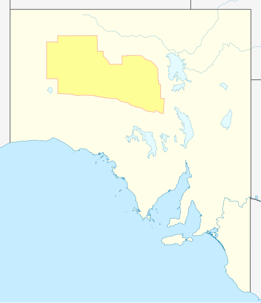
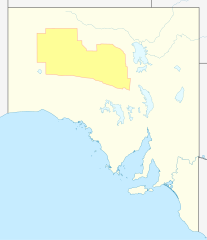
English: Approximate geographic map of Woomera Test Range in South Australia |
| Datum | (UTC) |
| Bron | |
| Auteur |
|
| Dit is een geretoucheerde foto, wat betekent dat de originele versie digitaal aangepast is. Aanpassingen: Added test range. Het origineel kan hier bekeken worden: Australia South Australia location map blank.svg. Aanpassingen gedaan door Pi.1415926535.
|
Ik, de auteursrechthebbende van dit werk, maak het hierbij onder de volgende licentie beschikbaar:
Dit bestand is gelicenseerd onder de Creative Commons-licentie Naamsvermelding-Gelijk delen 3.0 Unported
- De gebruiker mag:
- Delen – het werk kopiëren, verspreiden en doorgeven
- Remixen – afgeleide werken maken
- Onder de volgende voorwaarden:
- naamsvermelding – U moet op een gepaste manier aan naamsvermelding doen, een link naar de licentie geven, en aangeven of er wijzigingen in het werk zijn aangebracht. U mag dit op elke redelijke manier doen, maar niet zodanig dat de indruk wordt gewekt dat de licentiegever instemt met uw werk of uw gebruik van zijn werk.
- Gelijk delen – Als u het werk heeft geremixt, veranderd, of erop heeft voortgebouwd, moet u het gewijzigde materiaal verspreiden onder dezelfde licentie als het oorspronkelijke werk, of een daarmee compatibele licentie.
Oorspronkelijk uploadlogboek
This image is a derivative work of the following images:
- File:Australia_South_Australia_location_map_blank.svg licensed with Cc-by-sa-3.0
- 2010-04-10T00:34:15Z Roke 1535x1783 (323903 Bytes) {{Information |Description={{de|Positionskarte von [[:de:South Australia|South Australia]], [[:de:Australien|Australien]]}} Quadratische Plattkarte, N-S-Streckung 117 %. Geographische Begrenzung der Karte: * N: 25.6° S * S:
Uploaded with derivativeFX
Bestandsgeschiedenis
Klik op een datum/tijd om het bestand te zien zoals het destijds was.
| Datum/tijd | Miniatuur | Afmetingen | Gebruiker | Opmerking | |
|---|---|---|---|---|---|
| huidige versie | 13 jul 2011 04:36 | | 1.535 × 1.783 (318 kB) | Pi.1415926535 | {{Information |Description={{en|Approximate geographic map of Woomera Test Range in South Australia}} |Source=*File:Australia_South_Australia_location_map_blank.svg |Date=2011-07-13 02:28 (UTC) |Author=*[[:File:Australia_South_Australia_location_map |
Bestandsgebruik
Dit bestand wordt op de volgende pagina gebruikt:
Globaal bestandsgebruik
De volgende andere wiki's gebruiken dit bestand:
- Gebruikt op en.wikipedia.org
- Gebruikt op es.wikipedia.org
- Gebruikt op he.wikipedia.org
- Gebruikt op ja.wikipedia.org
- Gebruikt op pl.wikipedia.org
- Gebruikt op pt.wikipedia.org
- Gebruikt op simple.wikipedia.org
- Gebruikt op sl.wikipedia.org
- Gebruikt op zh.wikipedia.org