
Bestand:Yorkshire and the Humber counties 2023 map.svg

Afmetingen van deze voorvertoning van het type PNG van dit SVG-bestand: 705 × 600 pixels Andere resoluties: 282 × 240 pixels | 564 × 480 pixels | 903 × 768 pixels | 1.204 × 1.024 pixels | 2.408 × 2.048 pixels | 1.425 × 1.212 pixels.
Oorspronkelijk bestand (SVG-bestand, nominaal 1.425 × 1.212 pixels, bestandsgrootte: 1,09 MB)
| Dit is een bestand van Wikimedia Commons. Onderstaande beschrijving komt van de beschrijving van het bestand daar. |
Beschrijving
| Beschrijving |
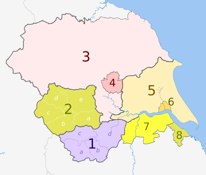
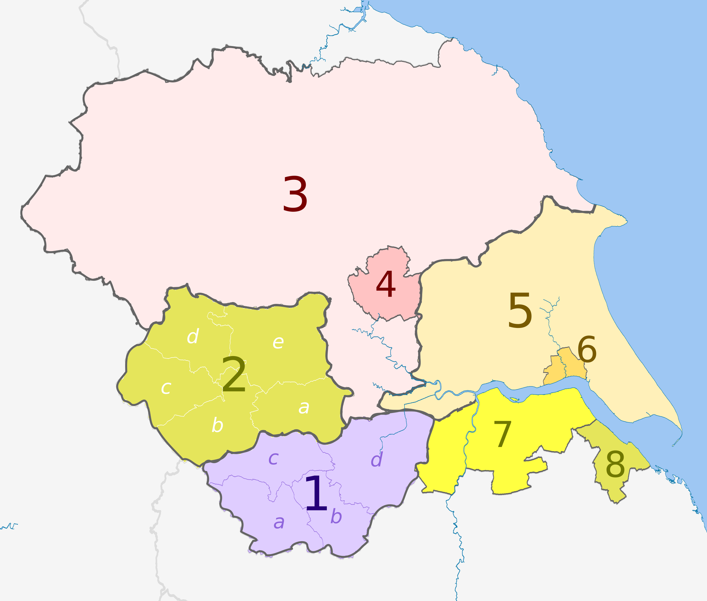
English: Map of the Yorkshire and the Humber region of England, showing its counties and administrative districts since 1 April 2023. The county colours are the same as those in File:English metropolitan and non-metropolitan counties 2009.svg.
Equirectangular map projection on WGS 84 datum, with N/S stretched 160% Geographic limits:
|
| Datum | |
| Bron |
Dit bestand is afgeleid van: Yorkshire and the Humber counties 2009 map.svg: |
| Auteur |
Key
| Strategic authority |
Ceremonial county |
Metropolitan or non-metropolitan county |
Metropolitan or non-metropolitan districts May also hold borough and/or city status |
|---|---|---|---|
| South Yorkshire | 1. South Yorkshire * | a) Sheffield, b) Rotherham, c) Barnsley, d) Doncaster | |
| West Yorkshire | 2. West Yorkshire * | a) Wakefield, b) Kirklees, c) Calderdale, d) Bradford, e) Leeds | |
| North Yorkshire (part only) |
3. North Yorkshire U.A. | ||
| 4. York U.A. | |||
| East Riding of Yorkshire | 5. East Riding of Yorkshire U.A. | ||
| 6. Kingston upon Hull U.A. | |||
| Lincolnshire (part only) |
7. North Lincolnshire U.A. | ||
| 8. North East Lincolnshire U.A. | |||
| (no county council) | |||
Licentie
Dit bestand is gelicenseerd onder de Creative Commons-licentie Naamsvermelding-Gelijk delen 3.0 Unported
Naamsvermelding: Dr Greg and Nilfanion. Contains Ordnance Survey data © Crown copyright and database right 2010
- De gebruiker mag:
- Delen – het werk kopiëren, verspreiden en doorgeven
- Remixen – afgeleide werken maken
- Onder de volgende voorwaarden:
- naamsvermelding – U moet op een gepaste manier aan naamsvermelding doen, een link naar de licentie geven, en aangeven of er wijzigingen in het werk zijn aangebracht. U mag dit op elke redelijke manier doen, maar niet zodanig dat de indruk wordt gewekt dat de licentiegever instemt met uw werk of uw gebruik van zijn werk.
- Gelijk delen – Als u het werk heeft geremixt, veranderd, of erop heeft voortgebouwd, moet u het gewijzigde materiaal verspreiden onder dezelfde licentie als het oorspronkelijke werk, of een daarmee compatibele licentie.
Bestandsgeschiedenis
Klik op een datum/tijd om het bestand te zien zoals het destijds was.
| Datum/tijd | Miniatuur | Afmetingen | Gebruiker | Opmerking | |
|---|---|---|---|---|---|
| huidige versie | 28 mei 2023 22:32 | | 1.425 × 1.212 (1,09 MB) | Dr Greg | Uploaded a work by * ''Yorkshire and the Humber counties 2009 map.svg'': Dr Greg and Nilfanion, contains Ordnance Survey data * derivative work: Dr Greg from {{Derived from|Yorkshire and the Humber counties 2009 map.svg|display=50}} with UploadWizard |
Bestandsgebruik
Dit bestand wordt op de volgende pagina gebruikt:
Globaal bestandsgebruik
De volgende andere wiki's gebruiken dit bestand:
- Gebruikt op de.wikipedia.org
- Gebruikt op en.wikipedia.org
- Gebruikt op pl.wikipedia.org