
Bestand:Åland Political Map-en.svg

Afmetingen van deze voorvertoning van het type PNG van dit SVG-bestand: 595 × 600 pixels Andere resoluties: 238 × 240 pixels | 476 × 480 pixels | 762 × 768 pixels | 1.016 × 1.024 pixels | 2.032 × 2.048 pixels | 996 × 1.004 pixels.
Oorspronkelijk bestand (SVG-bestand, nominaal 996 × 1.004 pixels, bestandsgrootte: 219 kB)
| Dit is een bestand van Wikimedia Commons. Onderstaande beschrijving komt van de beschrijving van het bestand daar. |
Beschrijving
| Beschrijving |
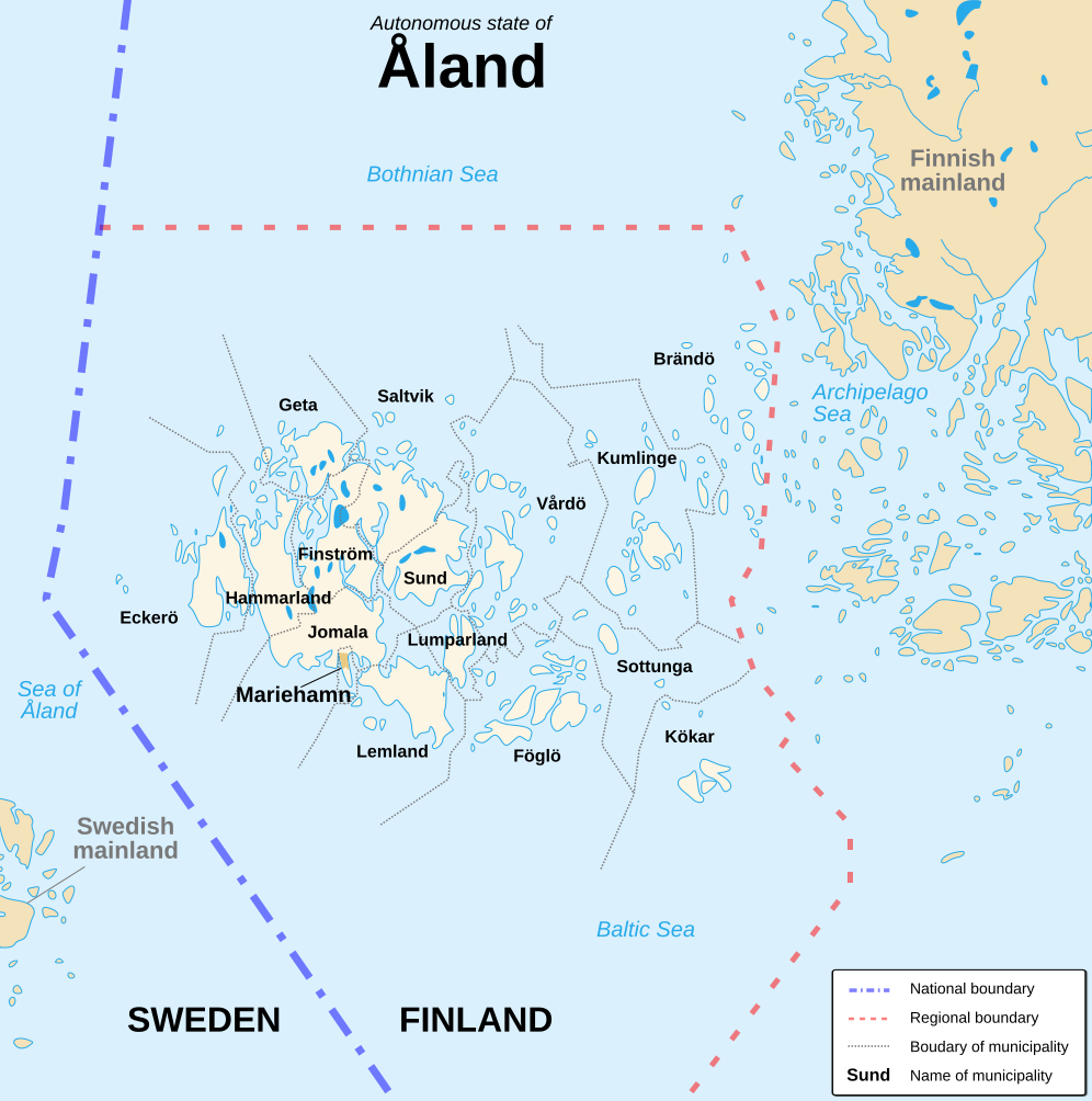
English: Political map of the autonomous finnish province of Åland, in english. Shows the national, regional and municipal boundaries about Åland islands. Français : Carte politique de l'État libre associé d'Åland, en anglais. La carte montre les frontières internationales, régionales et municipales concernant l'archipel d'Åland. |
||
| Datum | |||
| Bron |
English: Image:Alandmunicipalities.png and Image:Åland map.png, from Demis (see the approval e-mail and Demis forum). Français : Image:Alandmunicipalities.png et Image:Åland map.png, elles-même basées sur le site internet de Demis (voir le courriel d'autorisation et le forum de Demis). |
||
| Auteur | Sémhur (talk) | ||
| Andere versies |
|
||
| Naamsvermelding (required by the license) | © Sémhur / Wikimedia Commons / | ||
| SVG | W3C-validity not checked. Deze niet W3C-verklaarde vectorafbeelding is gemaakt met Inkscape .
|
||
| Atelier graphique |

| Cameralocatie | | Deze en andere afbeeldingen in: OpenStreetMap |
|---|
Licentie
Ik, de auteursrechthebbende van dit werk, maak het hierbij onder de volgende licenties beschikbaar:
| Copyleft: dit kunstwerk is vrij; u mag het heruitgeven en/of wijzigen in overeenkomst met de voorwaarden van de Free Art-licentie.
U kunt een voorbeeld van de licentie vinden op de website van Copyleft Attitude als ook op andere websites. |
This file is licensed under the Creative Commons Attribution-Share Alike 4.0 International, 3.0 Unported, 2.5 Generic, 2.0 Generic and 1.0 Generic license.
- De gebruiker mag:
- Delen – het werk kopiëren, verspreiden en doorgeven
- Remixen – afgeleide werken maken
- Onder de volgende voorwaarden:
- naamsvermelding – U moet op een gepaste manier aan naamsvermelding doen, een link naar de licentie geven, en aangeven of er wijzigingen in het werk zijn aangebracht. U mag dit op elke redelijke manier doen, maar niet zodanig dat de indruk wordt gewekt dat de licentiegever instemt met uw werk of uw gebruik van zijn werk.
- Gelijk delen – Als u het werk heeft geremixt, veranderd, of erop heeft voortgebouwd, moet u het gewijzigde materiaal verspreiden onder dezelfde licentie als het oorspronkelijke werk, of een daarmee compatibele licentie.
U mag zelf één van de licenties kiezen.
Bestandsgeschiedenis
Klik op een datum/tijd om het bestand te zien zoals het destijds was.
| Datum/tijd | Miniatuur | Afmetingen | Gebruiker | Opmerking | |
|---|---|---|---|---|---|
| huidige versie | 21 aug 2007 18:11 | | 996 × 1.004 (219 kB) | Sémhur | {{Information |Description=Political map of the autonomous finnish province of Åland, in english.<br/> Shows the national, regional and municipal boundaries about Åland islands. |Source=Own work. Based on Image:Alandmunicipalities.png and [[:Image: |
Bestandsgebruik
Dit bestand wordt op de volgende pagina gebruikt:
Globaal bestandsgebruik
De volgende andere wiki's gebruiken dit bestand:
- Gebruikt op ca.wikipedia.org
- Gebruikt op en.wikipedia.org
- Gebruikt op es.wikipedia.org
- Gebruikt op ga.wikipedia.org
- Gebruikt op gl.wikipedia.org
- Gebruikt op hy.wikipedia.org
- Gebruikt op li.wikipedia.org
- Gebruikt op ru.wikipedia.org
- Gebruikt op www.wikidata.org