
Bestand:France and its region.png
Grootte van deze voorvertoning: 524 × 600 pixels. Andere resoluties: 210 × 240 pixels | 419 × 480 pixels | 794 × 909 pixels.
Oorspronkelijk bestand (794 × 909 pixels, bestandsgrootte: 326 kB, MIME-type: image/png)
| Dit is een bestand van Wikimedia Commons. Onderstaande beschrijving komt van de beschrijving van het bestand daar. |
Beschrijving
| Beschrijving |
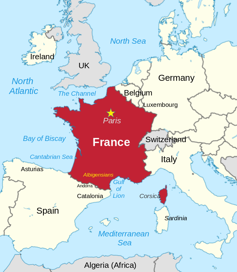
English: France and its neighbors |
||
| Datum | |||
| Bron | Modified File:France in European Union (-rivers -mini map).svg | ||
| Auteur | Thinker78, based on map by TUBS | ||
| Toestemming (Hergebruik van dit bestand) |
Dit bestand is gelicenseerd onder de Creative Commons Naamsvermelding 4.0 Internationaal licentie.
|
||
| Andere versies |
Dit bestand is gelicenseerd onder de Creative Commons-licentie Naamsvermelding-Gelijk delen 3.0 Unported Naamsvermelding: TUBS
|

.svg)
| Cameralocatie | | Deze en andere afbeeldingen in: OpenStreetMap |
|---|
Made with w:LibreOffice Draw
Licentie
Dit bestand is gelicenseerd onder de Creative Commons Naamsvermelding 4.0 Internationaal licentie.
- De gebruiker mag:
- Delen – het werk kopiëren, verspreiden en doorgeven
- Remixen – afgeleide werken maken
- Onder de volgende voorwaarden:
- naamsvermelding – U moet op een gepaste manier aan naamsvermelding doen, een link naar de licentie geven, en aangeven of er wijzigingen in het werk zijn aangebracht. U mag dit op elke redelijke manier doen, maar niet zodanig dat de indruk wordt gewekt dat de licentiegever instemt met uw werk of uw gebruik van zijn werk.
Bestandsgeschiedenis
Klik op een datum/tijd om het bestand te zien zoals het destijds was.
| Datum/tijd | Miniatuur | Afmetingen | Gebruiker | Opmerking | |
|---|---|---|---|---|---|
| huidige versie | 11 apr 2024 04:50 | | 794 × 909 (326 kB) | Thinker78 | added locations, improved format |
| 5 sep 2023 04:33 |  | 712 × 831 (231 kB) | Thinker78 | Added places names (Corsica, Sardinia, Gulf of Lion, Catalonia) | |
| 13 mei 2023 09:36 |  | 650 × 805 (197 kB) | Thinker78 | Uploaded a work by Thinker78, TUBS from File:France in European Union (-rivers -mini map).svg with UploadWizard |
Bestandsgebruik
Geen enkele pagina gebruikt dit bestand.
Globaal bestandsgebruik
De volgende andere wiki's gebruiken dit bestand:
- Gebruikt op blk.wikipedia.org
- Gebruikt op bn.wikipedia.org
- Gebruikt op en.wikipedia.org
- Gebruikt op so.wikipedia.org
- Gebruikt op tl.wikipedia.org