
Bestand:1859 Dufour Map of Hispaniola or Santo Domingo, West Indies (Haiti, Dominican Republic) - Geographicus - StDomingue-dufour-1859.jpg

Grootte van deze voorvertoning: 800 × 470 pixels. Andere resoluties: 320 × 188 pixels | 640 × 376 pixels | 1.024 × 602 pixels | 1.280 × 753 pixels | 2.560 × 1.505 pixels | 3.500 × 2.058 pixels.
Oorspronkelijk bestand (3.500 × 2.058 pixels, bestandsgrootte: 2,35 MB, MIME-type: image/jpeg)
| Dit is een bestand van Wikimedia Commons. Onderstaande beschrijving komt van de beschrijving van het bestand daar. |
_-_Geographicus_-_StDomingue-dufour-1859.jpg)
| Ile de St. Domingue. | ||||||
|---|---|---|---|---|---|---|
| Kunstenaar | ||||||
| Titel |
Ile de St. Domingue. |
|||||
| Beschrijving |
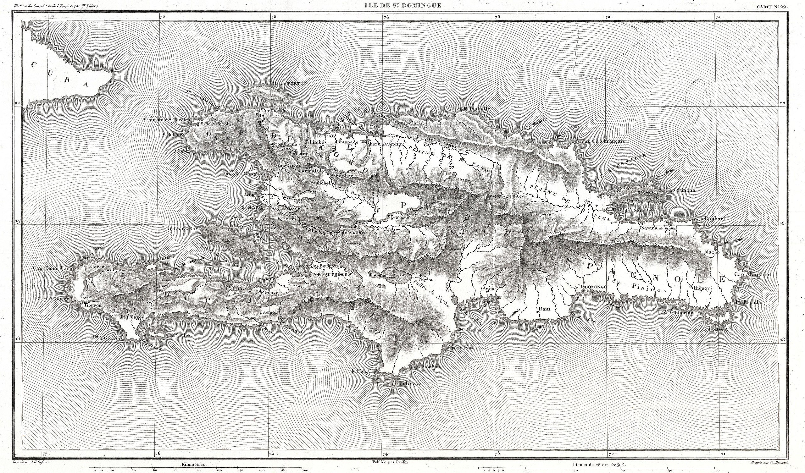
English: A beautifully engraved map of the West Indies island of Hispaniola or Santo Domingo by the French cartographer August Henri Dufour. Covers the entire island in striking topographical detail. Identifies towns, cities, rivers, lakes, mountains, and various undersea shoals and reefs. Names Mont Cibao, in the central part of the island, where Columbus famously failed to find rich gold mines. Today this island is divided between the Dominican Republic and Haiti. Drawn by A. H. Dufour and engraved by Charles Dyonnet for issue as map no. 22 in M. A. Thiers' History of the Consulate and the Empire of France Under Napoleon , 1859. |
|||||
| Datum | 1859 (undated) | |||||
| Afmetingen | hoogte: 8,5 in (21,5 cm); breedte: 14,5 in (36,8 cm) | |||||
| Inventarisnummer |
Geographicus link: StDomingue-dufour-1859 |
|||||
| Bron/fotograaf |
Thiers, M. A., History of the Consulate and the Empire of France Under Napoleon, 1859.
|
|||||
| Toestemming (Hergebruik van dit bestand) |
|
|||||
Bestandsgeschiedenis
Klik op een datum/tijd om het bestand te zien zoals het destijds was.
| Datum/tijd | Miniatuur | Afmetingen | Gebruiker | Opmerking | |
|---|---|---|---|---|---|
| huidige versie | 23 mrt 2011 23:32 | | 3.500 × 2.058 (2,35 MB) | BotMultichillT | {{subst:User:Multichill/Geographicus |link=http://www.geographicus.com/P/AntiqueMap/StDomingue-dufour-1859 |product_name=1859 Dufour Map of Hispaniola or Santo Domingo, West Indies (Haiti, Dominican Republic) |map_title=Ile de St. Domingue. |description=A |
Bestandsgebruik
Dit bestand wordt op de volgende 2 pagina's gebruikt:
Globaal bestandsgebruik
De volgende andere wiki's gebruiken dit bestand:
- Gebruikt op en.wikipedia.org
- Gebruikt op es.wikipedia.org
- Gebruikt op www.wikidata.org
_-_Geographicus_-_StDomingue-dufour-1859.jpg)