
Bestand:Cleomenes War detail 1.svg

Afmetingen van deze voorvertoning van het type PNG van dit SVG-bestand: 343 × 360 pixels Andere resoluties: 229 × 240 pixels | 457 × 480 pixels | 732 × 768 pixels | 976 × 1.024 pixels | 1.951 × 2.048 pixels.
Oorspronkelijk bestand (SVG-bestand, nominaal 343 × 360 pixels, bestandsgrootte: 931 kB)
| Dit is een bestand van Wikimedia Commons. Onderstaande beschrijving komt van de beschrijving van het bestand daar. |
Beschrijving
| Beschrijving |
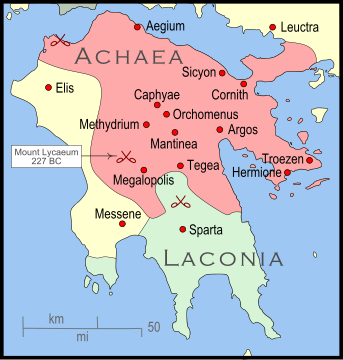
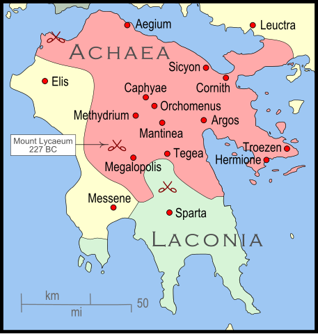
English: The Peleponnese (southernmost Greece) showing the larger powers and leagues at the time of the Cleomenean War (ca. 227 BC). The area in red shows the Achaean League. |
| Datum | |
| Bron | Eigen werk |
| Auteur | MapMaster |
| Andere versies |
[]
|


References
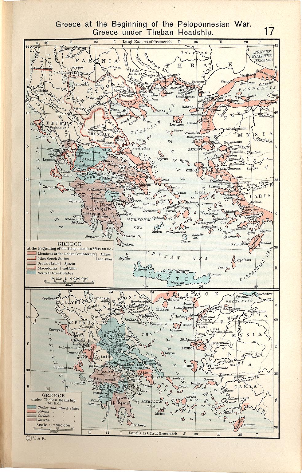
The map itself was built using a section of File:Greece map blank.svg. Towns were placed using geographic coordinates. There is some question where the ancient city of Messene was located. Maps (see "Greece under Theban Headship") place it well inland while the modern day Messene is close to the coast.
The borders of the various political entities were taken from several sources:
- Chamoux, François (2002) Hellenistic civilization, Wiley-Blackwell, ISBN 9780631222422, p. 206, for the Achaean League.
- Shepherd, William (1911) "Greece under Theban Headship", Historical Atlas, Henry Holt and Company. p. 17, was used as the primary reference for the Spartan borders. When there was a conflict with the Chamoux map, I used the Chamoux map.
Any additional information on borders and areas under control would be very welcome.
Similar maps

Licentie
Ik, de auteursrechthebbende van dit werk, maak het hierbij onder de volgende licentie beschikbaar:
Dit bestand is gelicenseerd onder de Creative Commons-licentie Naamsvermelding-Gelijk delen 3.0 Unported
- De gebruiker mag:
- Delen – het werk kopiëren, verspreiden en doorgeven
- Remixen – afgeleide werken maken
- Onder de volgende voorwaarden:
- naamsvermelding – U moet op een gepaste manier aan naamsvermelding doen, een link naar de licentie geven, en aangeven of er wijzigingen in het werk zijn aangebracht. U mag dit op elke redelijke manier doen, maar niet zodanig dat de indruk wordt gewekt dat de licentiegever instemt met uw werk of uw gebruik van zijn werk.
- Gelijk delen – Als u het werk heeft geremixt, veranderd, of erop heeft voortgebouwd, moet u het gewijzigde materiaal verspreiden onder dezelfde licentie als het oorspronkelijke werk, of een daarmee compatibele licentie.
Bestandsgeschiedenis
Klik op een datum/tijd om het bestand te zien zoals het destijds was.
| Datum/tijd | Miniatuur | Afmetingen | Gebruiker | Opmerking | |
|---|---|---|---|---|---|
| huidige versie | 12 jan 2010 06:35 | | 343 × 360 (931 kB) | MapMaster | Added a few more cities and some clean-up |
| 11 jan 2010 07:46 |  | 343 × 360 (911 kB) | MapMaster | Changed town names to paths to properly render them | |
| 11 jan 2010 07:38 |  | 343 × 360 (825 kB) | MapMaster | {{Information |Description={{en|1=The Peleponnese (southernmost Greece) showing the larger powers and leagues at the time of the Cleomenean War (ca. 227 BC). The area in red shows the Achaean League.}} |Source={{own}} |Author=MapMaster |
Bestandsgebruik
Dit bestand wordt op de volgende 2 pagina's gebruikt:
Globaal bestandsgebruik
De volgende andere wiki's gebruiken dit bestand:
- Gebruikt op bg.wikipedia.org
- Gebruikt op en.wikipedia.org
- Gebruikt op fr.wikipedia.org
- Gebruikt op id.wikipedia.org
- Gebruikt op ja.wikipedia.org
- Gebruikt op vi.wikipedia.org