
Bestand:Europe 1740.jpg
Grootte van deze voorvertoning: 736 × 600 pixels. Andere resoluties: 295 × 240 pixels | 589 × 480 pixels | 943 × 768 pixels | 1.257 × 1.024 pixels | 2.292 × 1.867 pixels.
Oorspronkelijk bestand (2.292 × 1.867 pixels, bestandsgrootte: 785 kB, MIME-type: image/jpeg)
| Dit is een bestand van Wikimedia Commons. Onderstaande beschrijving komt van de beschrijving van het bestand daar. |
Beschrijving
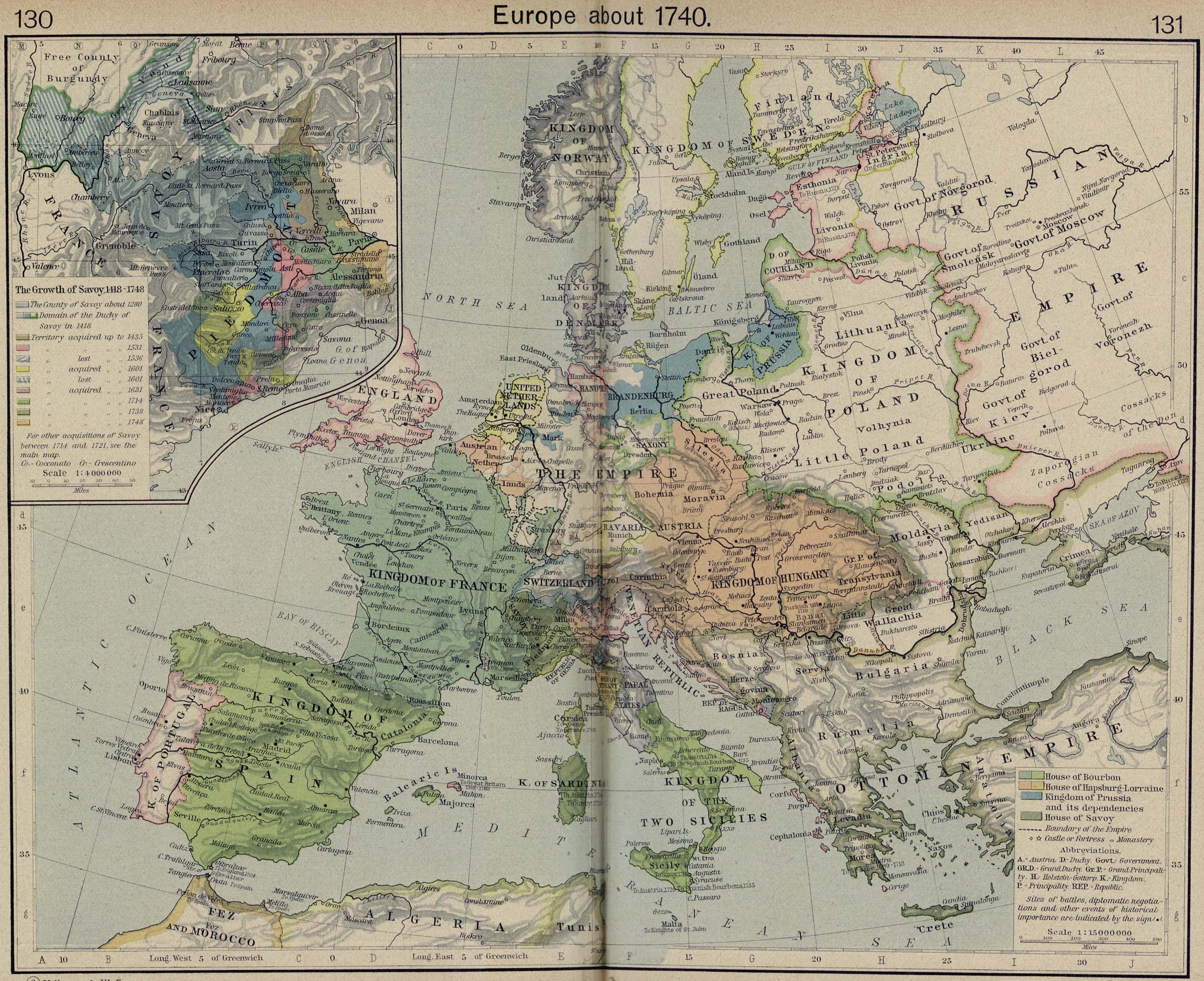
Europe in 1740, from The Historical Atlas by William R. Shepherd, 1926.
_en.png)
.png)
.jpg)
Licentie
|
Het tweedimensionale kunstwerk afgebeeld op deze afbeelding valt in het publiek domein omdat:
Reproducties van het werk kunnen ook worden beschouwd als publiek domein omdat ze geen oorspronkelijk karakter hebben. Dit geldt voor reproducties gemaakt in de Verenigde Staten (zie Bridgeman Art Library v. Corel Corp.), Duitsland en veel andere landen.
| ||||
Bestandsgeschiedenis
Klik op een datum/tijd om het bestand te zien zoals het destijds was.
| Datum/tijd | Miniatuur | Afmetingen | Gebruiker | Opmerking | |
|---|---|---|---|---|---|
| huidige versie | 8 mei 2006 12:33 | | 2.292 × 1.867 (785 kB) | Roke~commonswiki | Europe in 1740 {{Europe}} {{PD-PCL|http://www.lib.utexas.edu/maps/historical/shepherd/europe_1560.jpg}} Category: Historical maps of Europe |
Bestandsgebruik
Geen enkele pagina gebruikt dit bestand.
Globaal bestandsgebruik
De volgende andere wiki's gebruiken dit bestand:
- Gebruikt op de.wikipedia.org
- Gebruikt op el.wikipedia.org
- Gebruikt op en.wikipedia.org
- Gebruikt op incubator.wikimedia.org
- Gebruikt op mt.wikipedia.org
- Gebruikt op pl.wikipedia.org
- Gebruikt op pt.wikipedia.org
- Gebruikt op ro.wikipedia.org
- Gebruikt op ru.wikipedia.org
- Gebruikt op scn.wikipedia.org
- Gebruikt op sh.wikipedia.org
- Gebruikt op stq.wikipedia.org
- Gebruikt op szl.wikipedia.org