
Bestand:Europe 526-600.jpg

Grootte van deze voorvertoning: 381 × 599 pixels. Andere resoluties: 152 × 240 pixels | 305 × 480 pixels | 907 × 1.427 pixels.
Oorspronkelijk bestand (907 × 1.427 pixels, bestandsgrootte: 410 kB, MIME-type: image/jpeg)
| Dit is een bestand van Wikimedia Commons. Onderstaande beschrijving komt van de beschrijving van het bestand daar. |
Beschrijving
| Beschrijving |
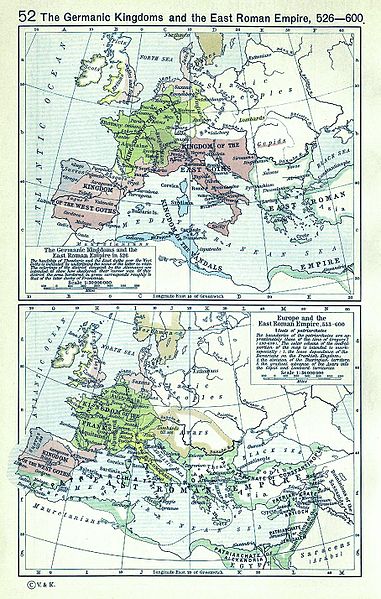
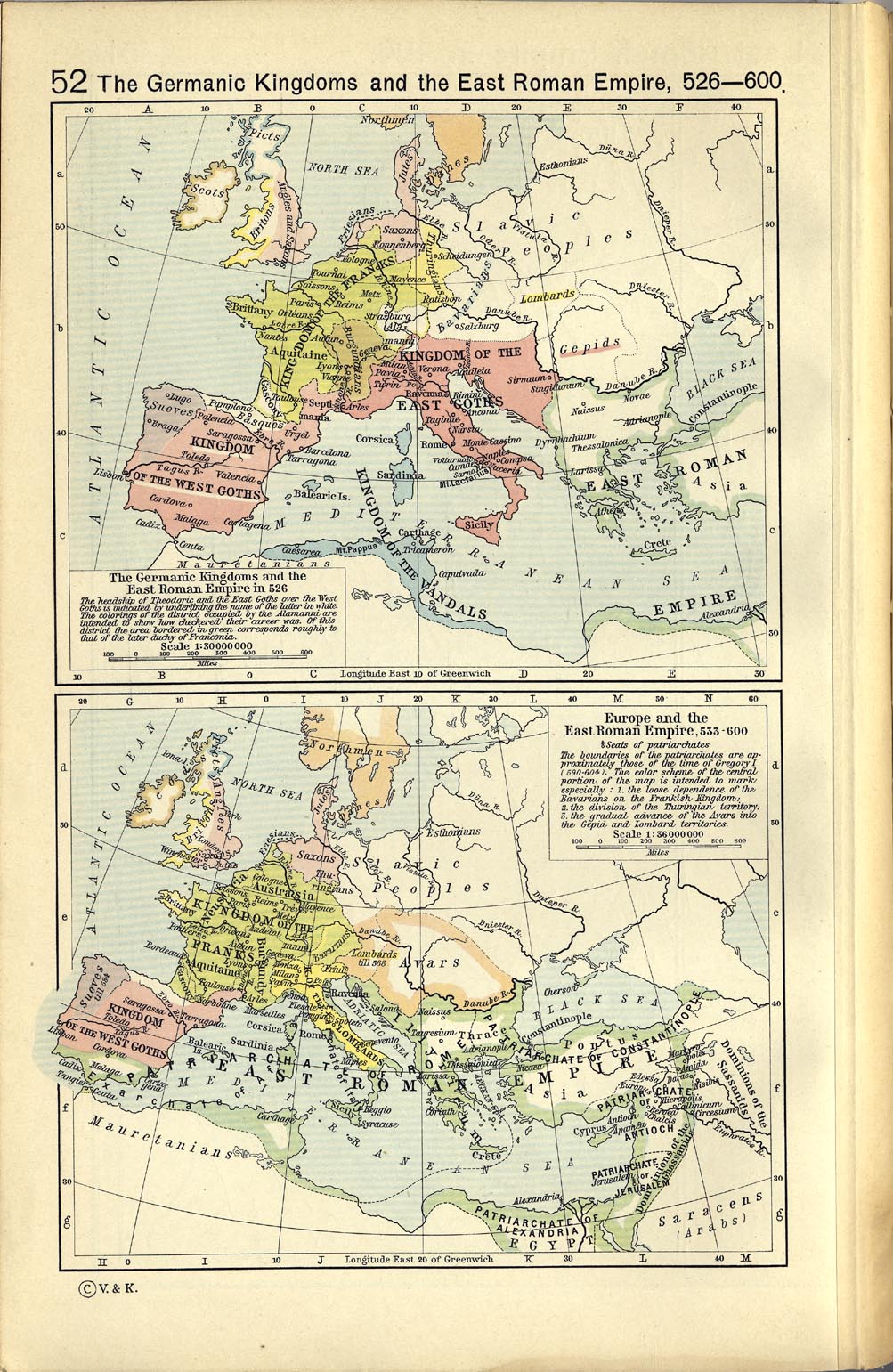
English: A map political map of Europe, situation as of c. 526-600 |
||||||||||||||||||||||
| Datum | |||||||||||||||||||||||
| Bron | Shepherd, William R. (1923) Historical Atlas, Category:New York: Henry Holt and Company | ||||||||||||||||||||||
| Auteur |
|
||||||||||||||||||||||
| Andere versies |
|
||||||||||||||||||||||
.jpg)

Licentie
|
De auteur overleed in 1934, dus dit werk bevindt zich in het publiek domein in landen en gebieden waar de auteursrechttermijn het leven van de auteur plus 80 jaar of minder is. Dit werk bevindt zich in het publiek domein in de Verenigde Staten omdat het gepubliceerd werd (of geregistreerd bij de U.S. Copyright Office) voor 1 januari 1929. | |
| Van dit bestand is vastgesteld dat er geen bekende auteursrechtaanspraken op rusten, alle aanverwante en naburige rechten daarbij inbegrepen. | |
_en.png)
.png)
.jpg)
Bestandsgeschiedenis
Klik op een datum/tijd om het bestand te zien zoals het destijds was.
| Datum/tijd | Miniatuur | Afmetingen | Gebruiker | Opmerking | |
|---|---|---|---|---|---|
| huidige versie | 13 mrt 2008 15:22 | | 907 × 1.427 (410 kB) | F l a n k e r | Cleaning (hope you likes) |
| 8 mei 2006 12:28 |  | 1.003 × 1.541 (391 kB) | Roke~commonswiki | Europe 526-600AD {{Europe}} {{PD-PCL|http://www.lib.utexas.edu/maps/historical/shepherd_1911/shepherd-c-052.jpg}} Category: Historical maps of Europe |
Bestandsgebruik
Geen enkele pagina gebruikt dit bestand.
Globaal bestandsgebruik
De volgende andere wiki's gebruiken dit bestand:
- Gebruikt op ba.wikipedia.org
- Gebruikt op bg.wikipedia.org
- Gebruikt op en.wikipedia.org
- Gebruikt op et.wikipedia.org
- Gebruikt op fr.wikipedia.org
- Gebruikt op it.wikipedia.org
- Gebruikt op mwl.wikipedia.org
- Gebruikt op pt.wikipedia.org
- Gebruikt op ru.wikipedia.org
- Gebruikt op scn.wikipedia.org
- Gebruikt op vi.wikipedia.org
- Gebruikt op zh.wikipedia.org