
Bestand:Francia occidentalis es.svg

Afmetingen van deze voorvertoning van het type PNG van dit SVG-bestand: 621 × 599 pixels Andere resoluties: 249 × 240 pixels | 497 × 480 pixels | 796 × 768 pixels | 1.061 × 1.024 pixels | 2.122 × 2.048 pixels | 1.091 × 1.053 pixels.
Oorspronkelijk bestand (SVG-bestand, nominaal 1.091 × 1.053 pixels, bestandsgrootte: 194 kB)
| Dit is een bestand van Wikimedia Commons. Onderstaande beschrijving komt van de beschrijving van het bestand daar. |
| Beschrijving |
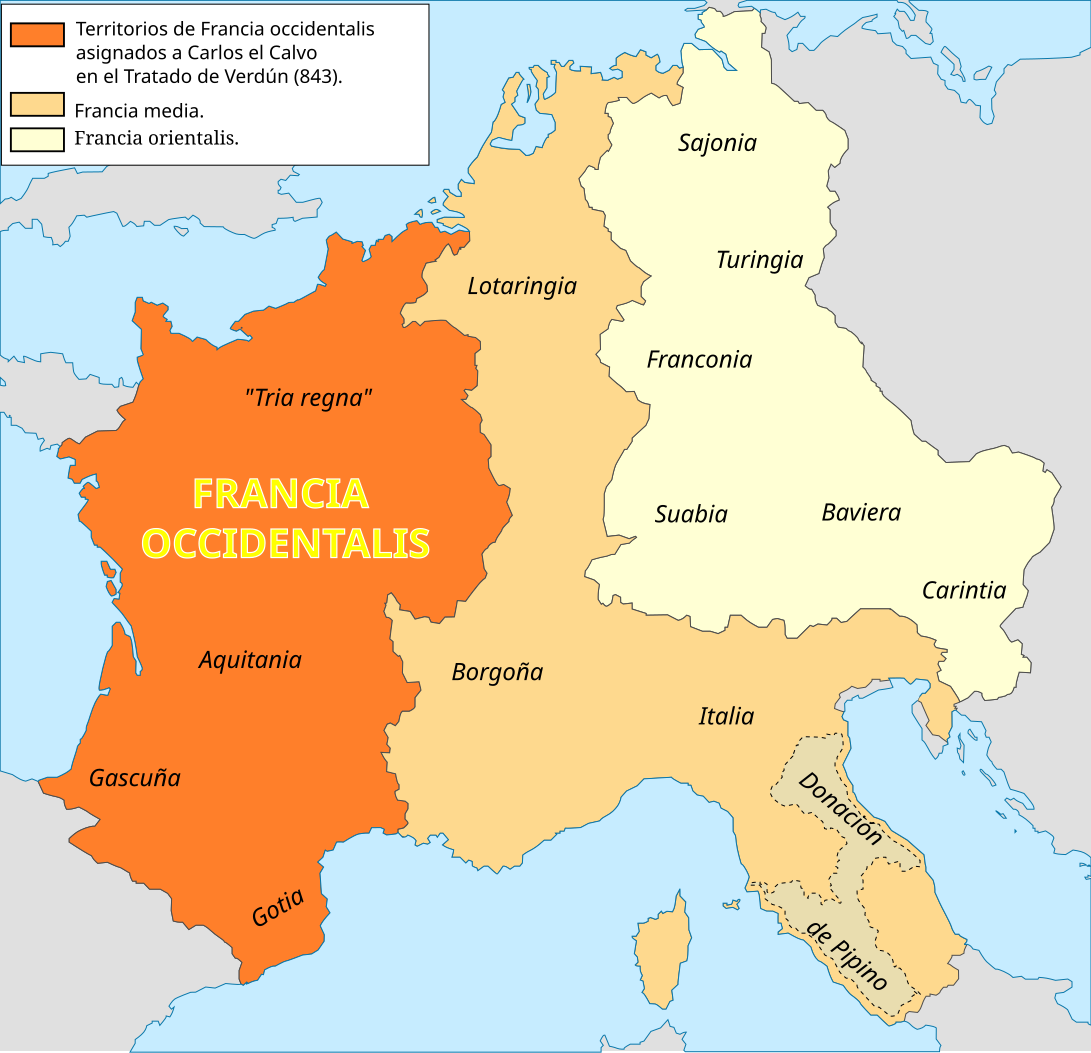
English: Francia occidentalis following the Treaty of Verdun (843)
Español: Francia occidentalis posterior al Tratado de Verdún (843) |
||
| Datum | |||
| Bron | Eigen werk | ||
| Auteur | Trasamundo | ||
| Toestemming (Hergebruik van dit bestand) |
Ik, de auteursrechthebbende van dit werk, maak het hierbij onder de volgende licenties beschikbaar:
Dit bestand is gelicenseerd onder de Creative Commons-licenties Naamsvermelding-Gelijk delen 3.0 Unported, 2.5 Algemeen, 2.0 Algemeen en 1.0 Algemeen.
U mag zelf één van de licenties kiezen. |
||
| Andere versies |
[]
|


References for Tria regna:
- [1]: Son trisième atout est la fusion des peuples dans les Trois règnes, les Tria regna que ses ancêtres lui ont légués
- [2]: The conquest was integrated into te Frankish kingdom as one of the "three [constituent] kingdoms" (tria regna) that endured to the eight century.
- [3]: A Senlis, les Evêques et les Grands du Tri Regna, la Neustrie, l'Austrase et la Bougogne - la coutume n'admet point à l'acclamatio ceux d'Aquitaine -, écoutent Adalbéron.
- [4]: Dans la future France, il y a certes plusieurs regna, mais la faculté d'élire comme celle d'être élu reste réservé aux Francs ou, pour être plus précis, au vieux noyau franc composé des tria regna, c'est-à-dire la Neustrie, l'Austrasie et la Bourgogne: on les avait tout simplement adaptés à une Francie (occidentale) devenue plus exiguë, formée de Francia entre Seine et Meuse, de la Neustria entre Seine et Loire, et du reste de la Burgundia encore considerée come le royaume de Bourgogne, jamais comme un simple duché.
References for Lotaringia:
- [5]:A Lotario II la Austrasia del lado acá del Rhin, que de su nombre fue llamada Lotaringia
Bestandsgeschiedenis
Klik op een datum/tijd om het bestand te zien zoals het destijds was.
| Datum/tijd | Miniatuur | Afmetingen | Gebruiker | Opmerking | |
|---|---|---|---|---|---|
| huidige versie | 1 sep 2016 11:24 | | 1.091 × 1.053 (194 kB) | Rowanwindwhistler | https://en.wikipedia.org/wiki/Wikipedia:WikiProject_Maps/Conventions http://colorbrewer2.org/#type=sequential&scheme=YlOrBr&n=5 Map was cleaned up and made smaller |
| 13 mrt 2010 20:14 |  | 1.091 × 1.053 (919 kB) | Trasamundo | Only the limits of the kingdoms established in the Treaty of Verdun. | |
| 14 jul 2009 17:10 |  | 1.091 × 1.040 (1,02 MB) | Trasamundo | {{Information |Description={{en|1=Francia media following the Treaty of Verdun (843)}} {{es|1=Francia media posterior al Tratado de Verdún (843)}} |Source=trabajo propio (own work) |Author=Trasamundo |Date=14 July 2009 |Permission={{s |
Bestandsgebruik
Dit bestand wordt op de volgende 2 pagina's gebruikt:
Globaal bestandsgebruik
De volgende andere wiki's gebruiken dit bestand:
- Gebruikt op cs.wikipedia.org
- Gebruikt op es.wikipedia.org
- Gebruikt op nn.wikipedia.org
- Gebruikt op no.wikipedia.org
- Gebruikt op vls.wikipedia.org