
Bestand:Isle au Haut trail map.pdf
Afmetingen van deze voorvertoning van het type JPG van dit PDF-bestand: 388 × 600 pixels Andere resoluties: 155 × 240 pixels | 310 × 480 pixels | 497 × 768 pixels | 662 × 1.024 pixels | 1.650 × 2.550 pixels.
Oorspronkelijk bestand (1.650 × 2.550 pixels, bestandsgrootte: 146 kB, MIME-type: application/pdf)
| Dit is een bestand van Wikimedia Commons. Onderstaande beschrijving komt van de beschrijving van het bestand daar. |
Beschrijving
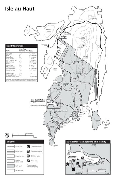
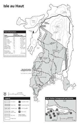
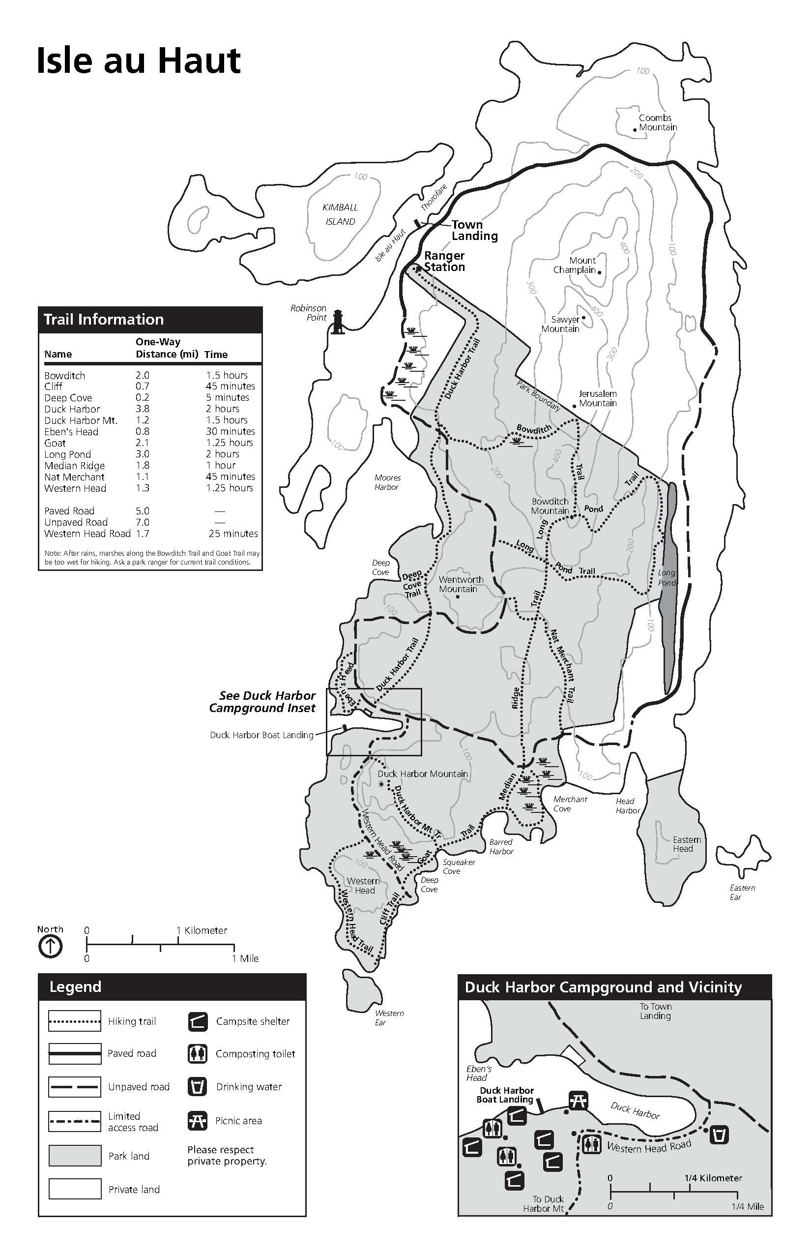
| Beschrijving | National Park Service trail map of Isle Au Haut in Acadia National Park, Maine, including trail distances and estimated hiking times. |
| Bron | http://www.nps.gov/acad/planyourvisit/upload/iahmap.pdf |
| Auteur |
Licentie
| Dit beeld- of mediabestand bevat materiaal gebaseerd op een werk van een National Park Service medewerker, gemaakt als onderdeel van de officiële taken van die persoon. Als een werk van de Amerikaanse federale overheid, bevindt dergelijk werk zich in het publieke domein in de Verenigde Staten. Zie de NPS website en NPS copyright policy voor meer informatie. |
Bestandsgeschiedenis
Klik op een datum/tijd om het bestand te zien zoals het destijds was.
| Datum/tijd | Miniatuur | Afmetingen | Gebruiker | Opmerking | |
|---|---|---|---|---|---|
| huidige versie | 20 apr 2008 05:42 | 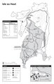 | 1.650 × 2.550 (146 kB) | Baileypalblue | {{Information |Description=National Park Service trail map of Isle Au Haut in Acadia National Park, Maine, including trail distances and estimated hiking times. |Source=http://www.nps.gov/acad/planyourvisit/upload/iahmap.pdf |Date=- |Author=- |Permission= |
Bestandsgebruik
Dit bestand wordt op de volgende pagina gebruikt: