
Bestand:Mercator projection of world with grid.png
Geen hogere resolutie beschikbaar.
Mercator_projection_of_world_with_grid.png (295 × 295 pixels, bestandsgrootte: 26 kB, MIME-type: image/png)
| Dit is een bestand van Wikimedia Commons. Onderstaande beschrijving komt van de beschrijving van het bestand daar. |
Beschrijving
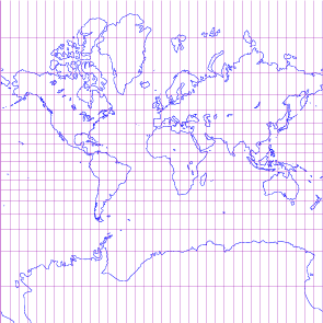
| Beschrijving | world map in Mercator projection with 10-degree grids, only in black lines on white background |
| Datum | |
| Bron | drawn by myself; using freely available materials especially DCL found at http://www.gfd-dennou.org/arch/dcl |
| Auteur | prasinos |
| Toestemming (Hergebruik van dit bestand) |
public domain |
Licentie
| Ik, de auteursrechthebbende van dit werk, geef dit werk vrij in het publieke domein. Dit is wereldwijd van toepassing. In sommige landen is dit wettelijk niet mogelijk; in die gevallen geldt: Ik sta iedereen toe dit werk voor eender welk doel te gebruiken, zonder enige voorwaarden, tenzij zulke voorwaarden door de wet worden voorgeschreven. |
Bestandsgeschiedenis
Klik op een datum/tijd om het bestand te zien zoals het destijds was.
| Datum/tijd | Miniatuur | Afmetingen | Gebruiker | Opmerking | |
|---|---|---|---|---|---|
| huidige versie | 14 okt 2007 21:11 | | 295 × 295 (26 kB) | Prasinos | {{Information |Description=world map in Mercator projection with 10-degree grids, blue continents and purple grauticle on white background |Source=drawn by myself with program http://apollo.ersc.wisc.edu/finch/zz2007/cartoplus/dcl-projfigs.shar using free |
| 30 sep 2007 19:14 |  | 295 × 295 (13 kB) | Prasinos | {{Information |Description=world map in Mercator projection with 10-degree grids, only in black lines on white background |Source=drawn by myself; using freely available materials especially DCL found at http://www.gfd-dennou.org/arch/dcl |Date=2007-10-01 |
Bestandsgebruik
Dit bestand wordt op de volgende pagina gebruikt: