
Bestand:Reliefkarte Malta.png

Grootte van deze voorvertoning: 645 × 600 pixels. Andere resoluties: 258 × 240 pixels | 516 × 480 pixels | 826 × 768 pixels | 1.131 × 1.052 pixels.
Oorspronkelijk bestand (1.131 × 1.052 pixels, bestandsgrootte: 443 kB, MIME-type: image/png)
| Dit is een bestand van Wikimedia Commons. Onderstaande beschrijving komt van de beschrijving van het bestand daar. |
Beschrijving
| Beschrijving |
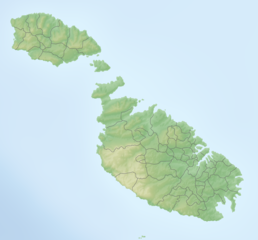
Deutsch: Reliefkarte Malta
Topographischer Hintergrund: NASA Shuttle Radar Topography Mission (public domain). SRTM3 v.2. |
||||||||
| Datum | |||||||||
| Bron | Eigen werk | ||||||||
| Auteur | Tschubby | ||||||||
| Toestemming (Hergebruik van dit bestand) |
Ik, de auteursrechthebbende van dit werk, maak het hierbij onder de volgende licenties beschikbaar:
Dit bestand is gelicenseerd onder de Creative Commons-licenties Naamsvermelding-Gelijk delen 2.5 Algemeen, 2.0 Algemeen en 1.0 Algemeen.
U mag zelf één van de licenties kiezen. |

Bestandsgeschiedenis
Klik op een datum/tijd om het bestand te zien zoals het destijds was.
| Datum/tijd | Miniatuur | Afmetingen | Gebruiker | Opmerking | |
|---|---|---|---|---|---|
| huidige versie | 6 jul 2019 09:25 | | 1.131 × 1.052 (443 kB) | Toghrul R | aspect ratio fix to match svg version |
| 5 mei 2018 09:05 |  | 1.172 × 1.052 (423 kB) | Tschubby | == {{int:filedesc}} == {{Information |Description= {{de| Reliefkarte Malta}} Topographischer Hintergrund: [http://www2.jpl.nasa.gov/srtm NASA Shuttle Radar Topography Mission] (public domain). SRTM3 v.2. |Source={{own}} |Date= 2018-05-05 |Author= Tschubby |Permission= {{self|GFDL|Cc-by-sa-3.0-migrated|Cc-by-sa-2.5,2.0,1.0}} |other_versions= }} Category:Location maps of Malta |
Bestandsgebruik
Dit bestand wordt op de volgende 10 pagina's gebruikt:
Globaal bestandsgebruik
De volgende andere wiki's gebruiken dit bestand:
- Gebruikt op az.wikipedia.org
- Gebruikt op bg.wikipedia.org
- Gebruikt op cv.wikipedia.org
- Gebruikt op da.wikipedia.org
- Gebruikt op de.wikipedia.org
- Malta
- Comino
- Cominotto
- Saint Paul’s Islands
- Filfla
- Ġgantija
- Sender Cyclops
- Ta’ Dmejrek
- Vorlage:Positionskarte Malta
- Ramla Bay (Gozo)
- Wikipedia:Kartenwerkstatt/Positionskarten/Europa
- Anchor Bay (Malta)
- Megalithische Tempel von Malta
- Chadwick Lakes
- Fungus Rock
- Santa Verna
- St Thomas Tower
- St Mary’s Tower
- Blaue Lagune (Malta)
- St Anthony Battery
- Daħlet Qorrot
- Għar ta’ Għejżu
- Gozokanal
- Santa Marija Battery
- Benutzer:Tschubby/Reliefkarten
- Mistra Battery
Globaal gebruik van dit bestand bekijken.