
Berinsfield
| Civil parish in Engeland | |||
|---|---|---|---|
 | |||
| Situering | |||
| Regio | South East England | ||
| Graafschap | Oxfordshire | ||
| District | South Oxfordshire | ||
| Coördinaten | 51° 40' NB, 1° 10' WL | ||
| Algemeen | |||
| Oppervlakte | 3,7211 km² | ||
| Inwoners (2011) |
2806 (754 inw./km²) | ||
| Overig | |||
| Postcode(s) | OX10 | ||
| Netnummer(s) | 01865 | ||
| Grid code | SU5796 | ||
| Post town | WALLINGFORD, OXFORDSHIRE | ||
| ONS-code | E04008106 | ||
| Website | Officiële website | ||
| Foto's | |||

| |||
| Hoofdstraat. | |||
| |||
Berinsfield is een civil parish in het bestuurlijke gebied South Oxfordshire, in het Engelse graafschap Oxfordshire met 2806 inwoners.
Geboren
[bewerken | brontekst bewerken]- Mark Wright (1963), Engels voetballer
-
 Pub
Pub -
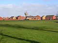 Huizen in Berinsfield


Bronnen, noten en/of referenties
Geplaatst op:
5-8-2010
5-8-2010
Dit artikel is een beginnetje over landen & volken. U wordt uitgenodigd om op bewerken te klikken om uw kennis aan dit artikel toe te voegen.