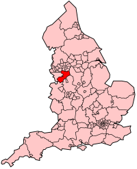
Cheshire East
| Unitaire autoriteit in Engeland | |||
|---|---|---|---|

| |||
| Situering | |||
| Land | Engeland | ||
| Regio | North West England | ||
| Coördinaten | 53°9'44"NB, 2°13'3"WL | ||
| Algemeen | |||
| Oppervlakte | 1166,3577[1] km² | ||
| Inwoners (2018[2]) |
380.790 (326 inw./km²) | ||
| ONS-code | E06000049 | ||
| |||
Cheshire East is een unitary authority en een district; Het ontstond in april 2009 na de samenvoeging van de districten Macclesfield, Congleton en Crewe and Nantwich. Het bestuurlijke gebied telt 378.846 inwoners (2017) op 1166 km².
Civil parishes in district Cheshire East[bewerken | brontekst bewerken]
Acton, Adlington, Agden, Alderley Edge, Alpraham, Alsager, Arclid, Ashley, Aston by Budworth, Aston juxta Mondrum, Audlem, Austerson, Baddiley, Baddington, Barthomley, Basford, Batherton, Betchton, Bexton, Bickerton, Blakenhall, Bollington, Bosley, Bradwall, Brereton, Bridgemere, Brindley, Broomhall, Buerton, Bulkeley, Bunbury, Burland, Calveley, Checkley cum Wrinehill, Chelford, Cholmondeley, Cholmondeston, Chorley (Wilmslow West and Chorley Ward), Chorley (Wrenbury Ward), Chorlton, Church Lawton, Church Lawton, Congleton, Coole Pilate, Cranage, Crewe, Crewe Green, Disley, Dodcott cum Wilkesley, Doddington, Eaton, Edleston, Egerton, Faddiley, Gawsworth, Goostrey, Great Warford, Handforth, Hankelow, Haslington, Hassall, Hatherton, Haughton, Henbury, Henhull, High Legh, Higher Hurdsfield, Holmes Chapel, Hough, Hulme Walfield, Hunsterson, Hurleston, Kettleshulme, Knutsford, Lea, Leighton, Little Bollington, Little Warford, Lower Withington, Lyme Handley, Macclesfield Forest and Wildboarclough, Marbury cum Quoisley, Marthall, Marton, Mere, Middlewich, Millington, Minshull Vernon, Mobberley, Moreton cum Alcumlow, Moston, Mottram St. Andrew, Nantwich, Nether Alderley, Newbold Astbury, Newhall, Norbury, North Rode, Odd Rode, Ollerton, Over Alderley, Peckforton, Peover Inferior, Peover Superior, Pickmere, Plumley, Poole, Pott Shrigley, Poynton-with-Worth, Prestbury, Rainow, Ridley, Rope, Rostherne, Sandbach, Shavington cum Gresty, Siddington, Smallwood, Snelson, Somerford, Somerford Booths, Sound, Spurstow, Stapeley, Stoke, Styal, Sutton, Swettenham, Tabley Inferior, Tabley Superior, Tatton, Toft, Twemlow, Walgherton, Wardle, Warmingham, Weston, Wettenhall, Willaston, Wilmslow, Wincle, Wirswall, Wistaston, Woolstanwood, Worleston, Wrenbury cum Frith, Wybunbury.
Bronnen, noten en/of referenties
|
