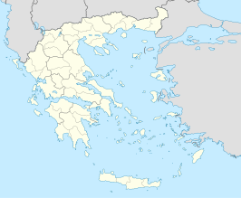
Sjabloon:Infobox gemeente Griekenland
Uiterlijk
| Gemeente in Griekenland | |||
|---|---|---|---|
| Coördinaten | 0° 0′ NB, 0° 0′ OL | ||
| |||
| Gemeente in Griekenland | |||
|---|---|---|---|
|
CITY_FLAG
CITY_SEAL
| |||
Situering
| |||
| Periferie | PERIPH | ||
| Coördinaten | 40° 51′ NB, 25° 52′ OL | ||
Algemeen
| |||
| Oppervlakte | 111 km² | ||
| Inwoners (2001[1]) |
444.444 (4.004 inw./km²) | ||
| Hoogte | ELEVMIN tot MAX m | ||
Politiek
| |||
| Burgemeester | BURGEMEESTER (sinds SINCE) | ||
| Partij | PARTY | ||
Overig
| |||
| Postcode(s) | POST | ||
| Netnummer(s) | AREA | ||
| Kenteken | ΕΒ | ||
| Website | WEBSITE | ||
| |||
Gebruik
{{Infobox gemeente Griekenland
| name             =
| name_local       =
| flag_reg         =
| periph           =
| regionaam        =
| prefec           =
| districts        =
| population       =
| population_as_of =
| population_ref   =
| area             =
| elevation        =
| postal_code      =
| area_code        =
| licence          =
| mayor            =
| website          =
| city_flag        =
| city_seal        =
| districts        =
| party            =
| since            =
| elevation_min    =
| elevation_max    =
| lat_deg          =
| lat_min          =
| lon_deg          =
| lon_min          =
}}
Bronnen, noten en/of referenties
- ↑ 2001 Census. National Statistical Service of Greece (ΕΣΥΕ). www.statistics.gr. Geraadpleegd op 15 januari 2008.

