Babergh
| Niet-metropolitaans district in Engeland | |||
|---|---|---|---|

| |||
| Situering | |||
| Land | Engeland | ||
| County | Suffolk | ||
| Regio | East of England | ||
| Coördinaten | 52°2'53"NB, 0°56'53"OL | ||
| Algemeen | |||
| Oppervlakte | 593,8220[1] km² | ||
| Inwoners (2018[2]) |
91401 (154 inw./km²) | ||
| ONS-code | E07000200 | ||
| Detailkaart | |||
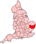
[[Bestand: |266px|class=notpageimage|alt=Kaart van Babergh]] |266px|class=notpageimage|alt=Kaart van Babergh]]
| |||
| |||
Babergh is een Engels district in het shire-graafschap (non-metropolitan county OF county) Suffolk en telt 91.000 inwoners. De oppervlakte bedraagt 594 km².
Van de bevolking is 18,4% ouder dan 65 jaar. De werkloosheid bedraagt 2,2% van de beroepsbevolking (cijfers volkstelling 2001).
Civil parishes in district Babergh[bewerken | brontekst bewerken]
Acton, Aldham, Alpheton, Arwarton, Assington, Belstead, Bentley, Bildeston, Boxford, Boxted, Brantham, Brent Eleigh, Brettenham, Bures St. Mary, Burstall, Capel St. Mary, Chattisham, Chelmondiston, Chelsworth, Chilton, Cockfield, Copdock and Washbrook, East Bergholt, Edwardstone, Elmsett, Freston, Glemsford, Great Cornard, Great Waldingfield, Groton, Hadleigh, Harkstead, Hartest, Higham, Hintlesham, Hitcham, Holbrook, Holton St. Mary, Kersey, Kettlebaston, Lavenham, Lawshall, Layham, Leavenheath, Lindsey, Little Cornard, Little Waldingfield, Long Melford, Milden, Monks Eleigh, Nayland-with-Wissington, Nedging-with-Naughton, Newton, Pinewood, Polstead, Preston St. Mary, Raydon, Semer, Shelley, Shimpling, Shotley, Somerton, Sproughton, Stanstead, Stoke-by-Nayland, Stratford St. Mary, Stutton, Sudbury, Tattingstone, Thorpe Morieux, Wattisham, Wenham Magna, Wenham Parva, Whatfield, Wherstead, Woolverstone.
Bronnen, noten en/of referenties
|
