
Rocky Harbour
| Plaats in Canada | |||
|---|---|---|---|
 | |||
| Situering | |||
| Provincie | Newfoundland en Labrador | ||
| Coördinaten | 49° 36′ NB, 57° 55′ WL | ||
| Algemeen | |||
| Oppervlakte | 12,08 km² | ||
| Inwoners (2016) |
947 (78,4 inw./km²) | ||
| Overig | |||
| Netnummer | 709 | ||
| Tijdzone | UTC−3:30 | ||
| Website | Officiële website | ||
| Foto's | |||

| |||
| Rocky Harbour bij zonsondergang (2009) | |||
| |||
Rocky Harbour is een gemeente (town) in de Canadese provincie Newfoundland en Labrador.
Geografie
De gemeente ligt in het zuidwesten van het Great Northern Peninsula aan de westkust van het eiland Newfoundland. Rocky Harbour ligt aan de oever van Bonne Bay, centraal in het nationaal park Gros Morne. De plaats is bereikbaar via provinciale route 430.
Demografie
Demografisch gezien is Rocky Harbour, net zoals de meeste kleine dorpen op Newfoundland, aan het krimpen. Tussen 1991 en 2016 daalde de bevolkingsomvang van 1.138 naar 947. Dat komt neer op een daling van 16,8% in 25 jaar tijd.
| Jaar | Aantal inwoners | Verschil | Referentie |
|---|---|---|---|
| 1991 | 1.138 | – | [1] |
| 1996 | 1.066 | [1] | |
| 2001 | 1.002 | [1] | |
| 2006 | 978 | [2] | |
| 2011 | 979 | [3] | |
| 2016 | 947 | [3] |
Fotogalerij
-
 Rotsachtige kust aan de rand van Rocky Harbour
 -
 Een straat in een typische woonwijk
 -
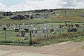 Gemeentelijke begraafplaats


Zie ook
Bronnen, noten en/of referenties
- ↑ a b c (en)
 Statistics Canada, 'Population of Communities by Census Consolidated Subdivision. Newfoundland and Labrador, 1991, 1996 and 2001 Censuses'.
- ↑ (en) Statistics Canada, 'Population by Census Subdivision (CSD). Newfoundland and Labrador. 2006 Census'.
- ↑ a b (en) Statistics Canada, 'Population and Dwelling Count Highlight Tables, 2016 Census (Newfoundland en Labrador)'.